The Collins farm, Crumlin, Co.Dublin
- Sources yet to be consulted:
- Collins deeds search in
[LR].
- Estate papers of Collins landlords.
There seem to be multiple landlords.
The Collins farm,
Crumlin, Co.Dublin.
Patrick Collins
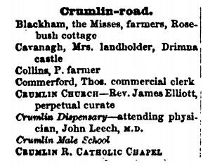
was a farmer and market gardener at Crumlin.
He
is listed
at "Crumlin Road", Crumlin, in
[Pettigrew & Oulton]
1838 to 1843
and
[Thom's] 1850 to 1877.
His son
Christopher Collins
is listed
at "Crumlin Road", Crumlin, in
[Thom's] 1882 to 1884.
Christopher died at "Cross-roads, Crumlin" in 1884.
The Collins farm was W side of St.Mary's Road.
The house was apparently close to the junction with Crumlin Road.
Entire site cleared for housing in 20th century.
The house is gone.
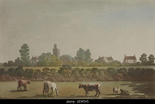
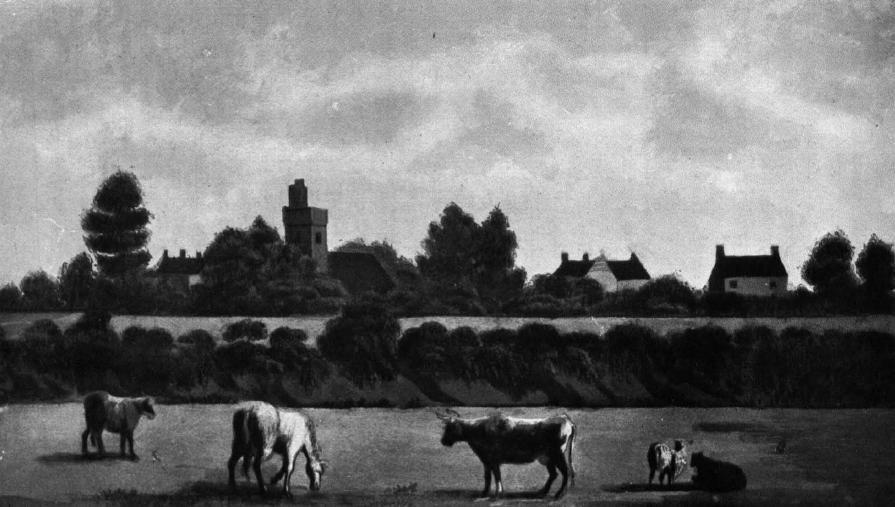
Crumlin, picture published in London by Francis Jukes, 1799.
From
alamy.com.
See also
black and white copy
printed under CRUMLIN in
[Ball, vol.4, 1906, p.135].
This says the scene is from 1795.
[Watchorn, 1985, p.33, p.92]
shows this is a view from Crumlin Commons to the SW side of the village.
The church is the CoI church (Old St Mary's Church).
The houses to the right of it are the houses along the main street of Crumlin.
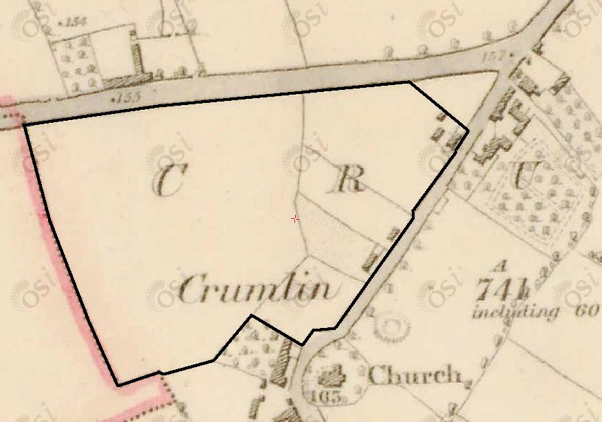
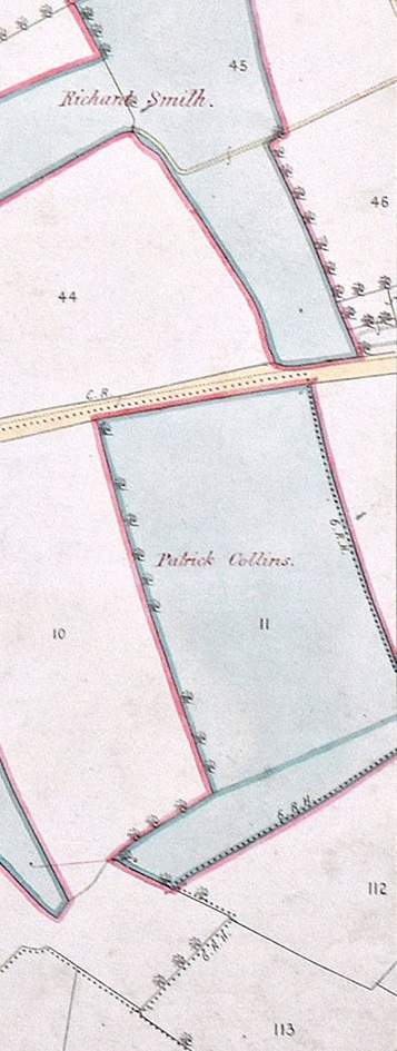
The central part of the Patrick Collins property
in Crumlin on
1829 to 1842 map.
The house near the cross-roads would seem to be the Collins house (see below).
See original.

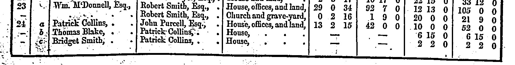
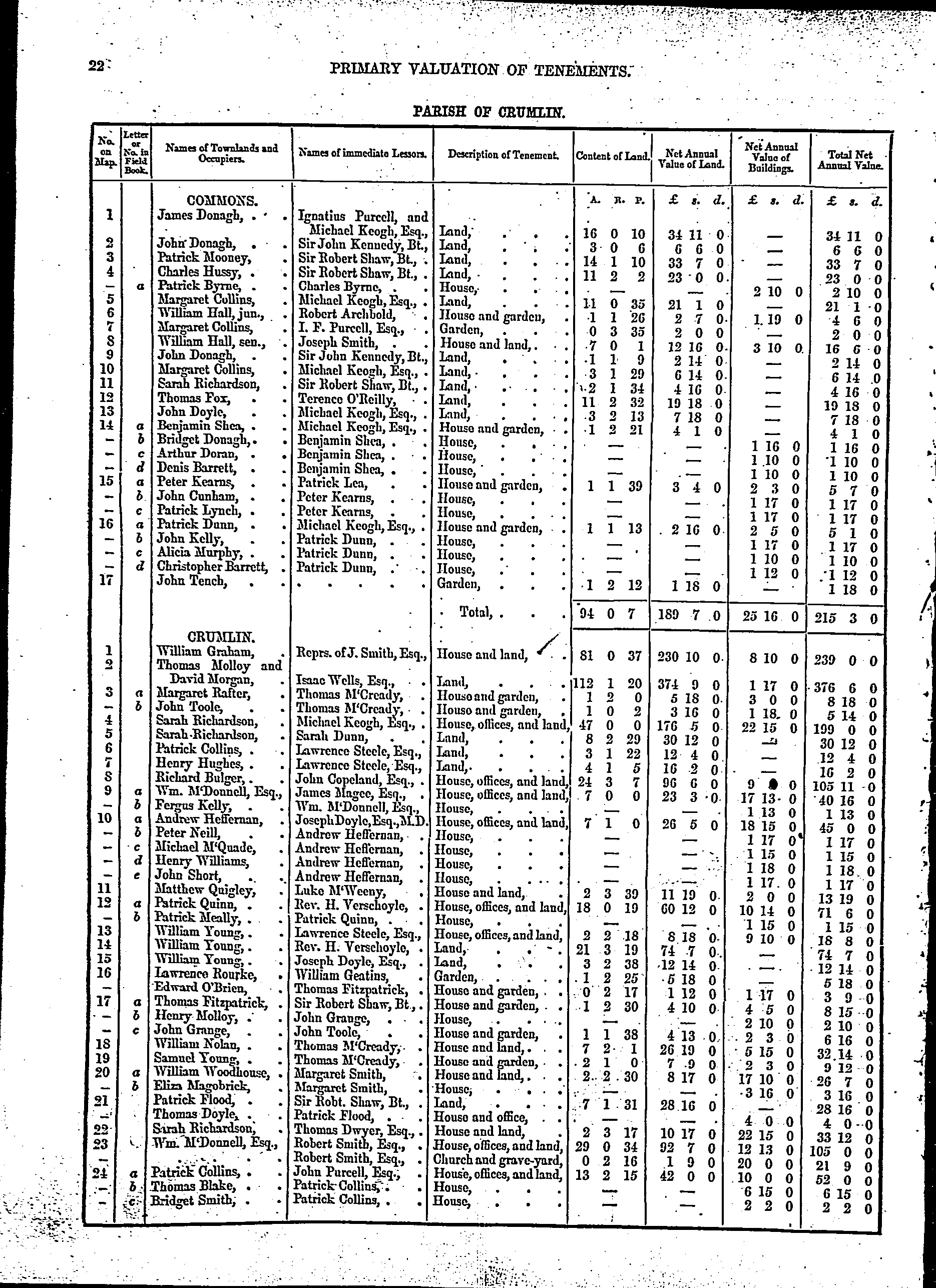
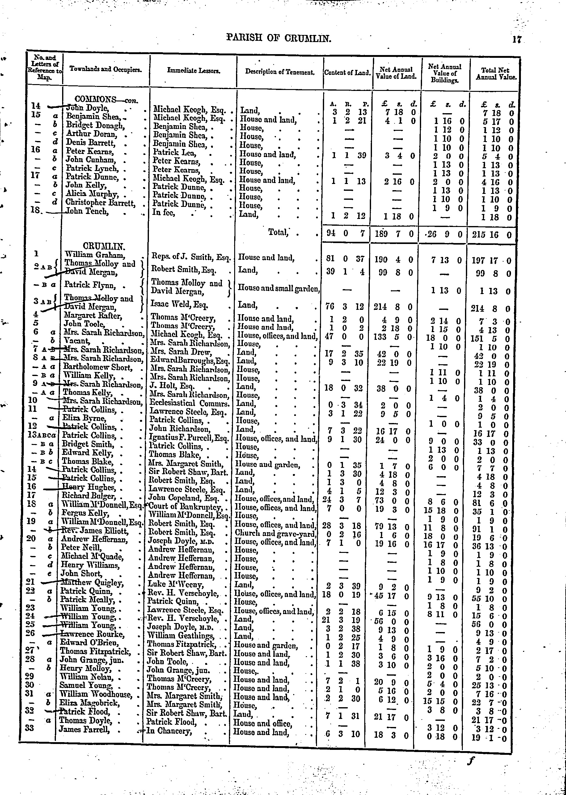
Part of entry for Crumlin townland, Crumlin par,
in
[Griffiths Valuation, 1847].
See full size
p.1 and
p.2.
Patrick Collins clearly lives at plot 24a (a decent size house with 13 acres).
He is also:
- renting a plot of 3 acres with no house (plot 6)
- sub-letting a building to Thomas Blake (plot 24 b)
- sub-letting a small building to Bridget Smith (plot 24 c)
- sub-letting a small building to Edward Kelly (plot 24 d)
- renting a plot of 7 acres with no house (plot 25)

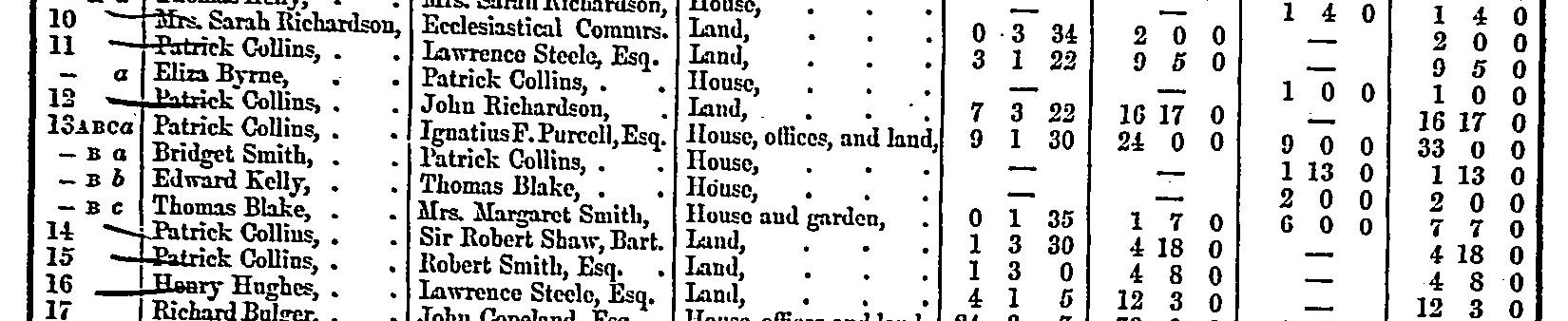
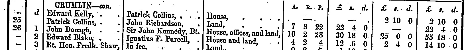
Part of entry for Crumlin townland, Crumlin par,
in
[Griffiths Valuation, 1850].
See
full size.
Patrick Collins clearly lives at plot 13 (a decent size house with 9 acres).
He is also:
- renting a plot of 3 acres with no house (plot 11)
- sub-letting a small building to Eliza Byrne (plot 11 a)
- renting a plot of 7 acres with no house (plot 12)
- sub-letting a small building to Bridget Smith (plot 13 a)
- renting a plot of 1 acre with no house (plot 14)
- renting a plot of 1 acre with no house (plot 15)
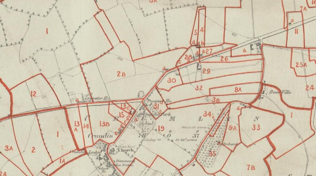
The Patrick Collins properties
in Crumlin, on
Griffiths Valuation map from
askaboutireland.ie.
This map matches
[Griffiths Valuation, 1850].
The Patrick Collins properties
are:
- Plot 12 (to the W). 7 acres.
- Plot 13 (in Crumlin village). 9 acres. Collins house.
- Plot 14 (in Crumlin village). 1 acre.
- Plot 15 (in Crumlin village). 1 acre.
- Plot 11 (to the E). 3 acres. Tiny house for tenant.
See also
map 18 (damaged)
in Griffiths Valuation maps, Dublin county,
[VO].
[Watchorn, 1985, p.91]
has a map of c.1917
showing the area around plot 1
as
"Crumlin Common".
It also show "The Commons" to the SW and S of the village.
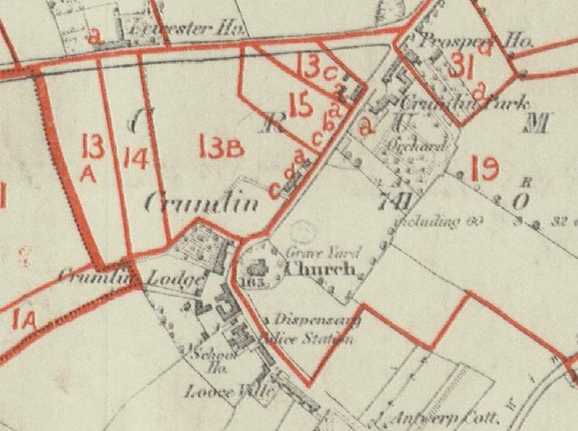
Close-up of the Patrick Collins property
in Crumlin village:
- Plot 13. 9 acres. Collins house.
- Plot 14. 1 acre.
- Plot 15. 1 acre.
13C seems to be where Patrick Collins himself lived.
This would also match the Collins address of "Cross-roads, Crumlin".
If he lived in the 13B section, it would not really be the cross-roads.
Note
Leicester House
to the N.
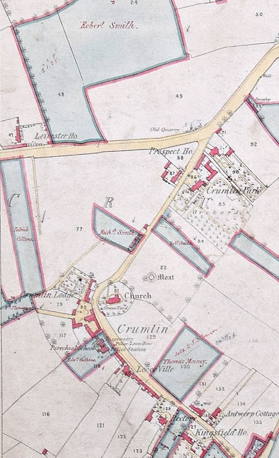
 Patrick Collins
listed
at Crumlin Road, Crumlin, in
[Thom's, 1850, p.840].
Property held by Patrick Collins
in map of the Shaw estate
as at 1879.
He holds
the property corresponding to
plots 1 and 1A and 14 on the Griffith's map above.
He may of course
hold more property that is not part of the Shaw estate.
From
here
and
here
in
Maps of the Shaw estate, 1879.
Based on Ordnance Survey maps of 1866.
The apparent Collins house
is visible, below the label for
"Prospect House", which is not that house
but rather the house across the road (as shown on map below).
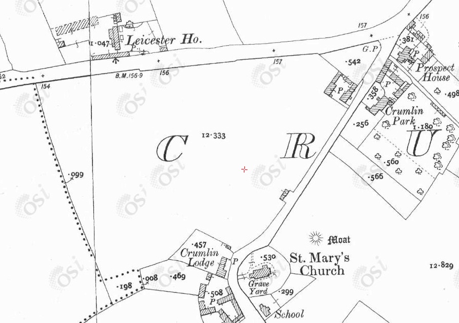
On the
1887 to 1913 map
the Collins farm still exists, as does the house near the cross-roads.
[Watchorn, 1985, p.85]
has a map of c.1937 which names that house as "The Cottage".
- Can't see any listing for "The Cottage" in
[Thom's, 1905].
-
Peyton Warren is listed at The Cottage, Crumlin road, in
[Thom's]
at least 1910 to 1914.
See entry
in 1911 census.
Peyton Warren listed at The Cottage, Crumlin road, Crumlin, in
[Thom's, 1910, p.1737].
-
[Watchorn, 1985, p.91]
has a map of c.1917 showing the house at this location as
Balfe's house.
-
James Balfe is listed at The Cottage, Crumlin road, in
[Thom's]
at least 1919 to 1945.
- Can't see any listing for "The Cottage" in
[Thom's, 1951].
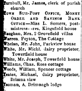
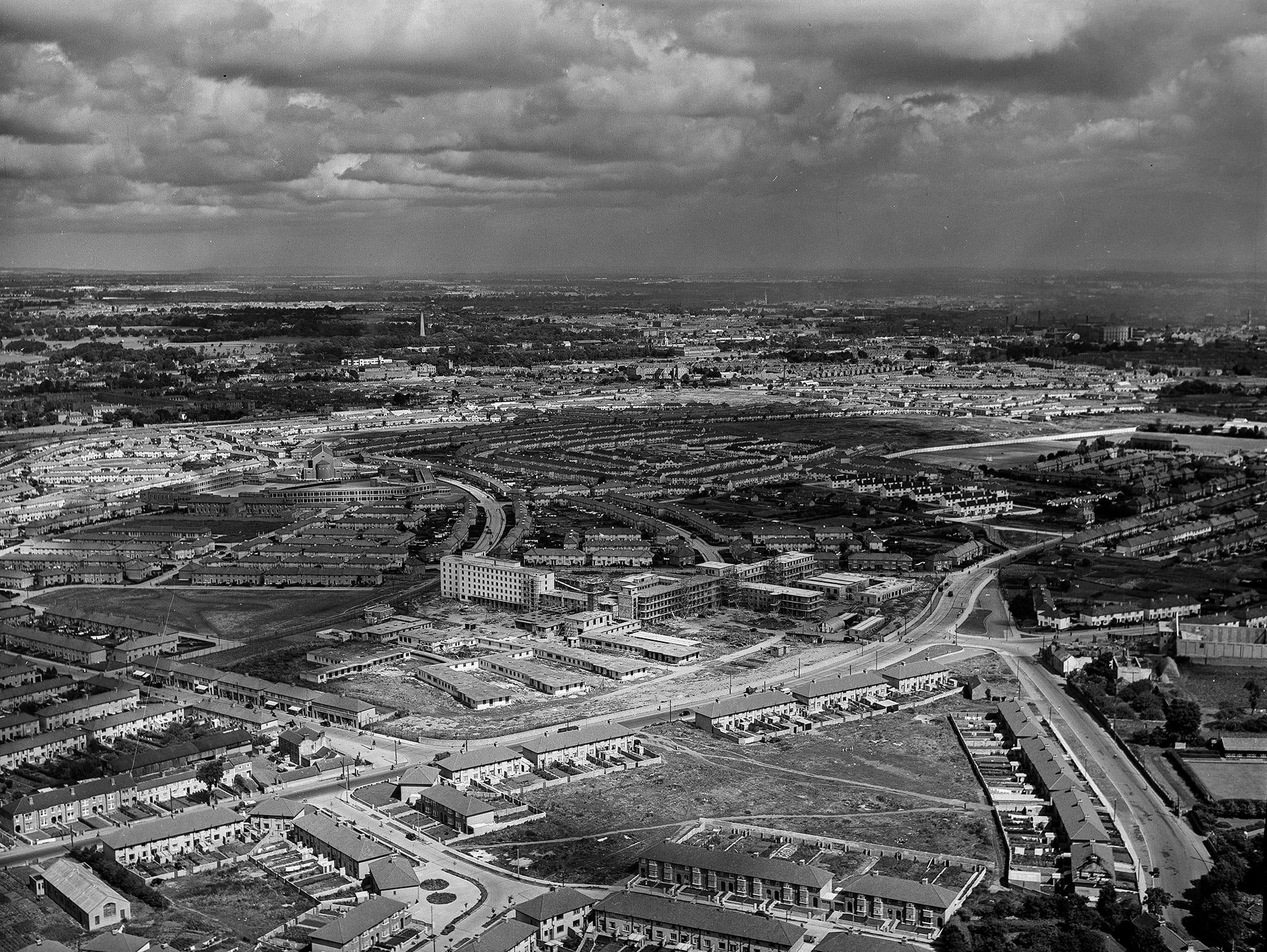
Aerial photo of Crumlin, 1940s.
Children's Hospital not yet started. Photo is before 1949.
New housing is being built on the Collins farm.
Looks like a remnant of the
Collins buildings still exists.
From p.33 of
Crumlin Heritage Audit Report.
See
full size.
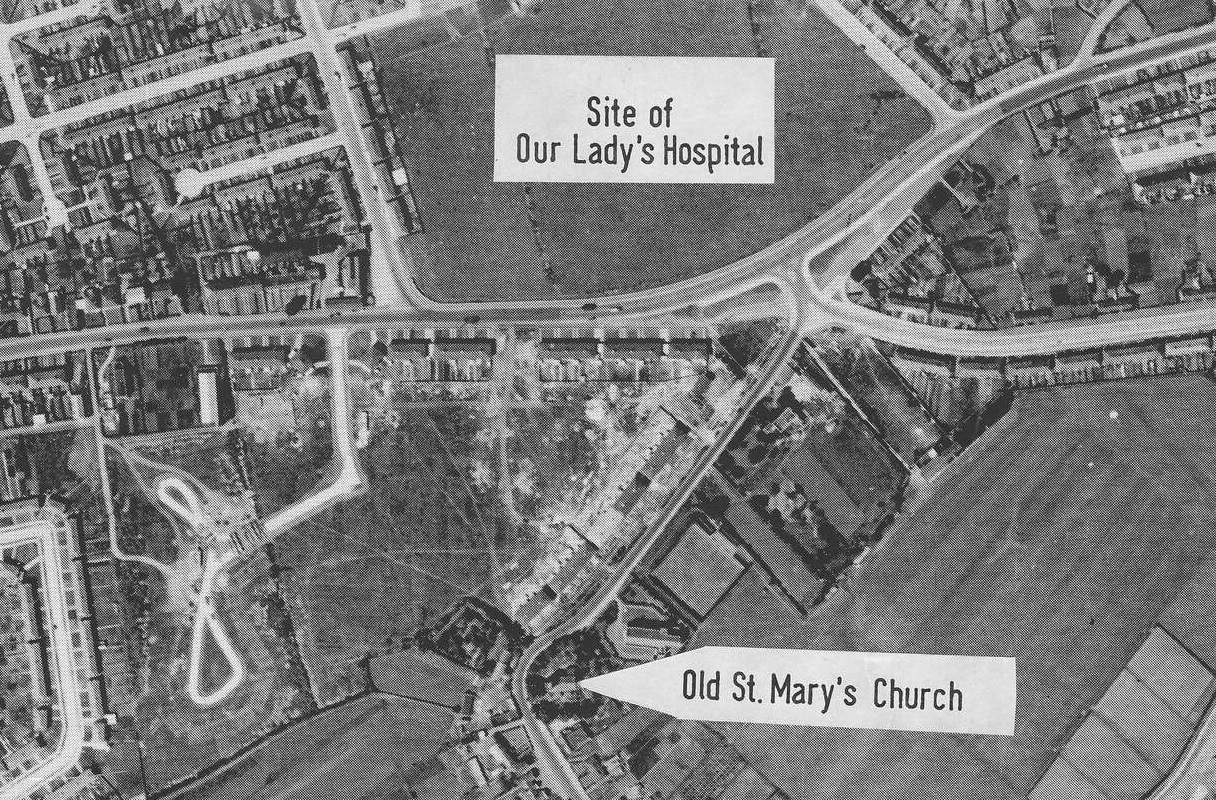
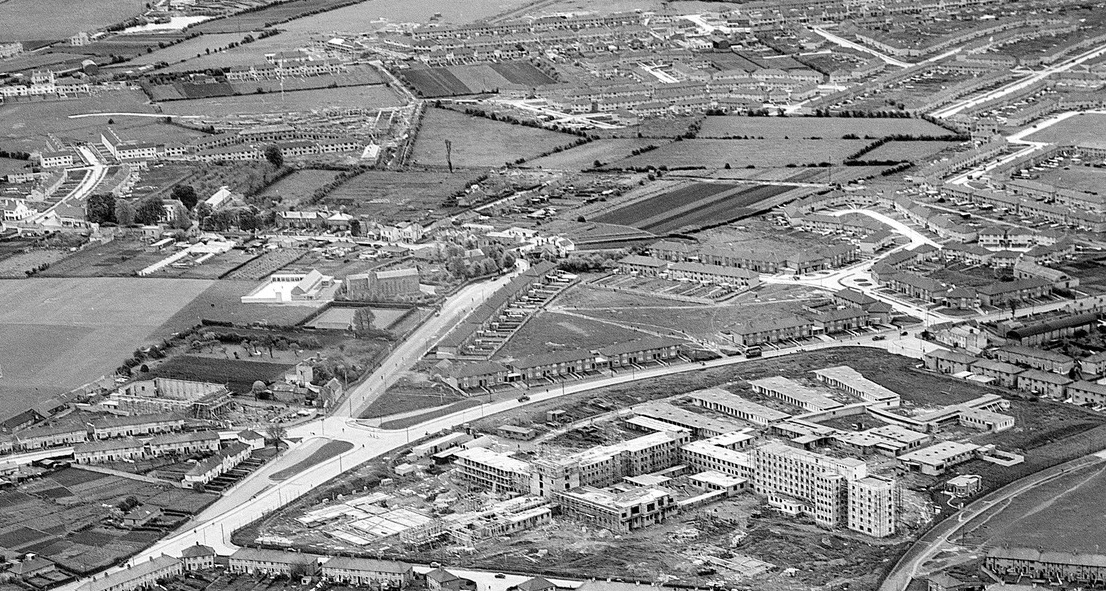
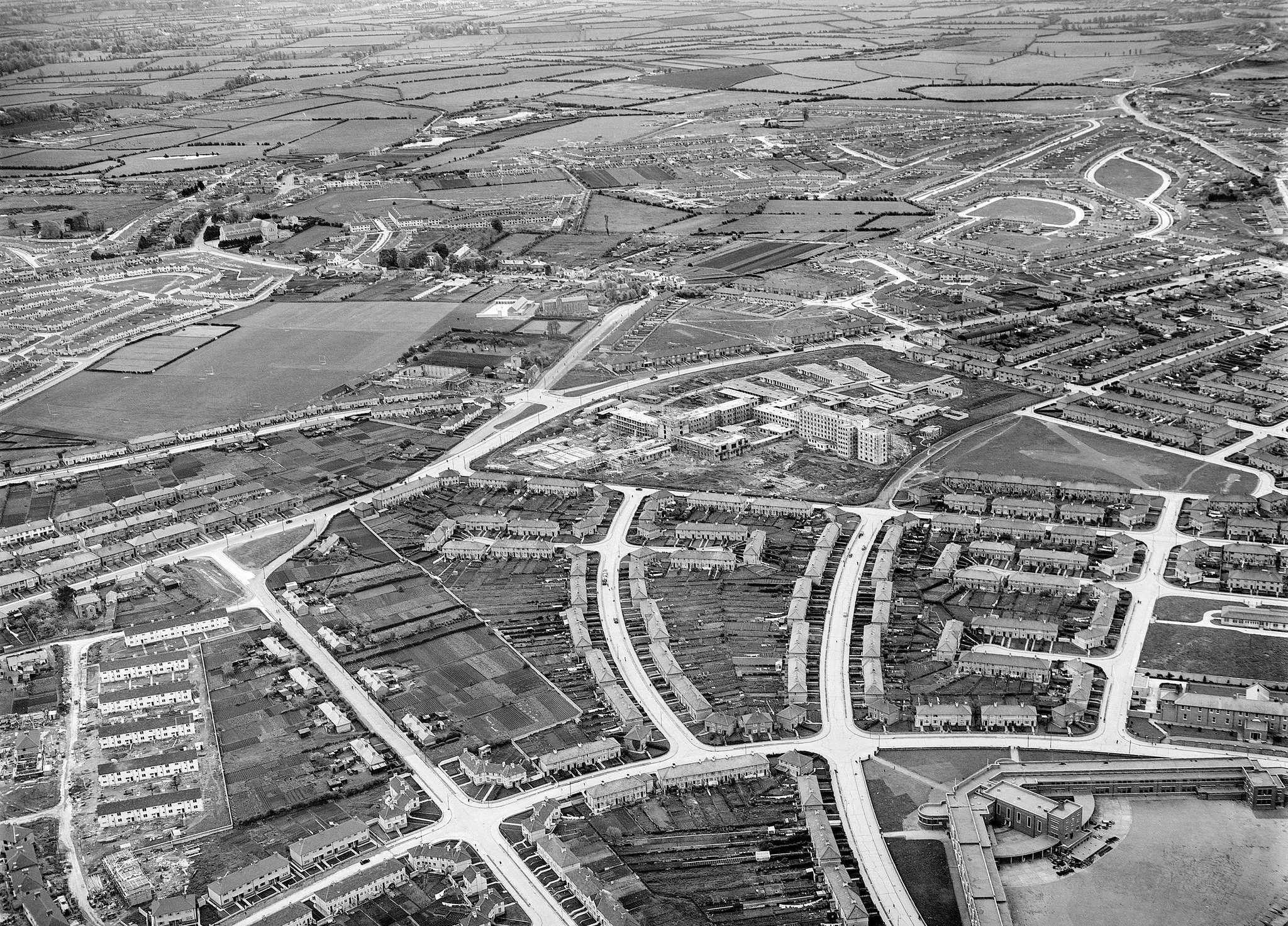
Aerial photo of Crumlin, 1952-1954.
View from S.
During the period when the Children's Hospital was being built (1949-1956).
New housing is being built on the Collins farm.
Looks like a remnant of the
Collins buildings still exists.
From
The Old Drone: Norman Ashe Aerial Photographic Collection.
Norman Ashe photos are 1952-1954.
See full size.
Close-up of the possible remnant of the
Collins buildings.
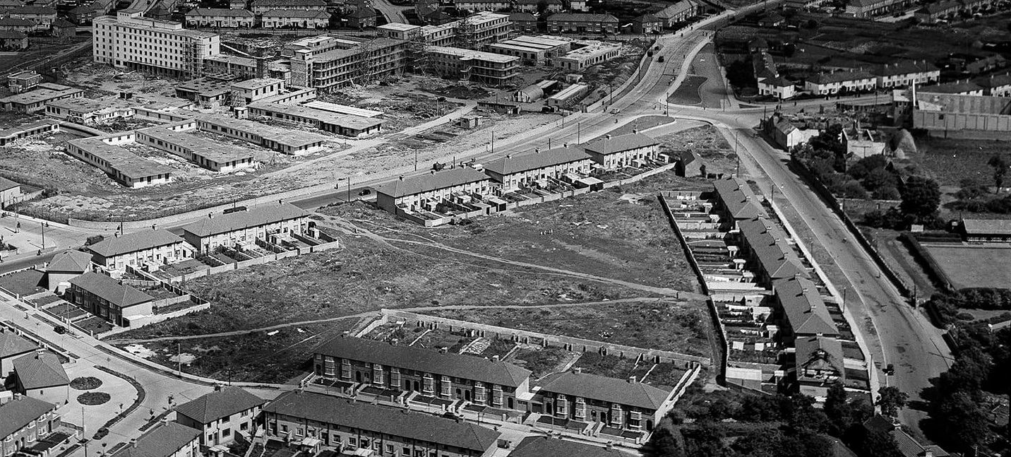
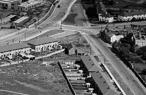
Aerial photo of Crumlin, 1952-1954.
During the period when the Children's Hospital was being built (1949-1956).
Page 91 of Crumlin Heritage Audit Report
thinks this photo is 1952.
Photo looks
down St.Mary's Road into Crumlin.
Collins farm would be on RHS.
New housing on the Collins farm.
Looks like a remnant of the
Collins buildings still exists.
From
The Old Drone: Norman Ashe Aerial Photographic Collection.
Norman Ashe photos are 1952-1954.
See full size.
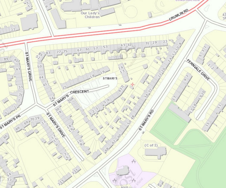
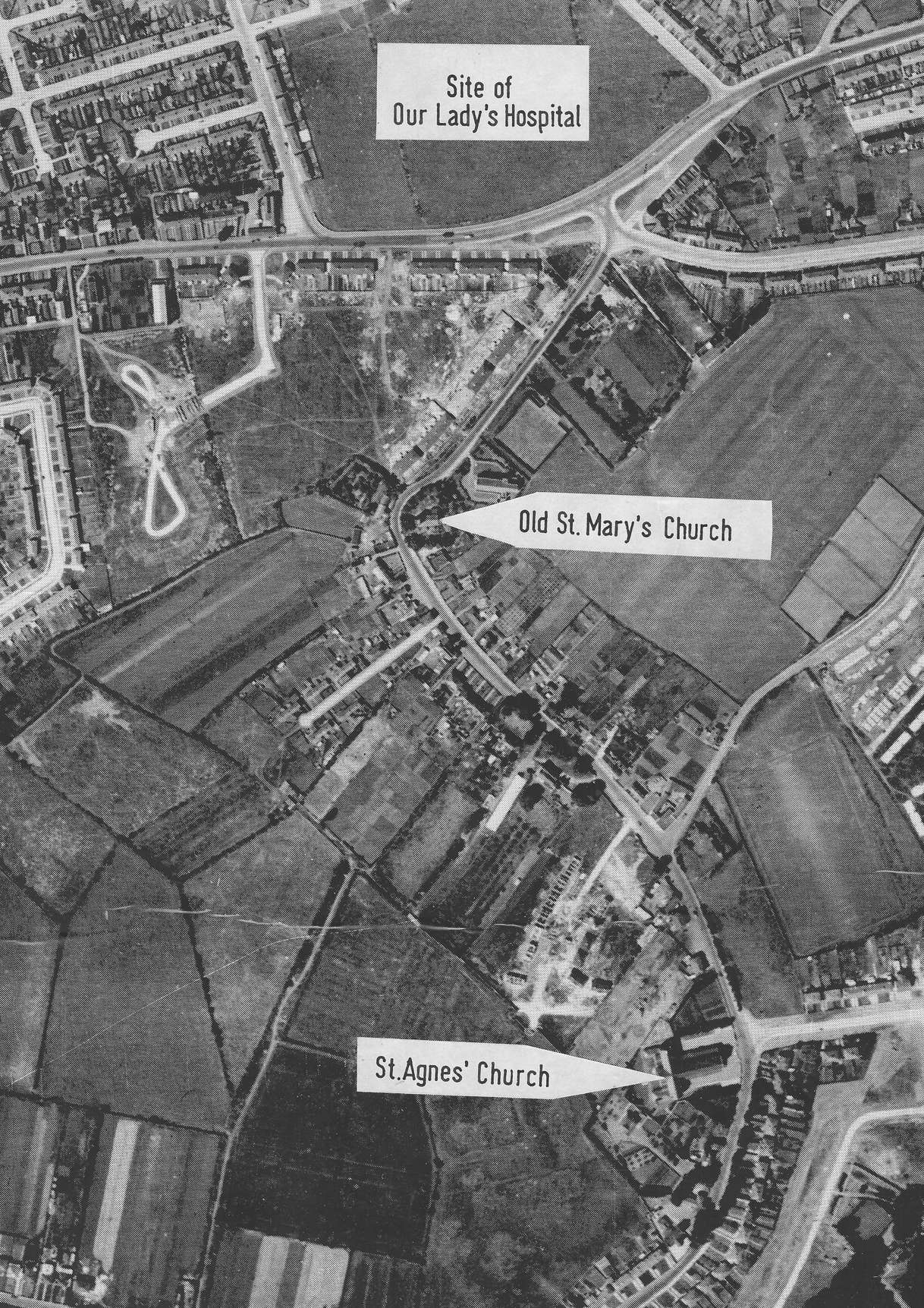
On the
modern map
the area is completely cleared for a housing estate.
The house is gone.
See Google Maps.
The apparent location of the Collins house
would be at the end of the row of houses / start of the row of shops, near the cross-roads.
See
street view.
Just nothing left today.
