Baggotrath Castle stood on what is now Upper Baggot St, Dublin.
Baggotrath Castle was built early 1300s by the Bagod family,
after whom the castle and now surrounding streets are named.
It was
occupied 1379 by
William Fitzwilliam.
Then by Sir Edward Perrers 1403.
His widow died 1441. The castle was taken by an executor of her will.
It was seized back for the Fitzwilliam and Perrers families
by their daughter's husband
William Fitzwilliam 1441.
Seat of the Fitzwilliam family until
Sir Thomas Fitzwilliam, Kt
moved to Merrion Castle
around 1550.
Baggotrath Castle was destroyed 1649,
in the time of the Royalist
1st Viscount Fitzwilliam,
as part of the fighting leading to the
Battle of Rathmines.
The castle was abandoned, and fell into total ruin in the early 1700s.
Baggotrath Castle was visited by Austin Cooper in 1778
and described by him think 1780.
The ruins were entirely demolished and cleared sometime in 1821 to 1842,
as the area around the Grand Canal was developed.
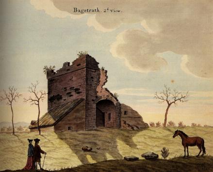
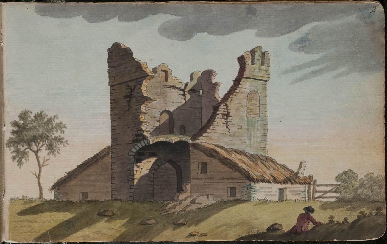
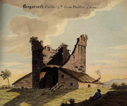
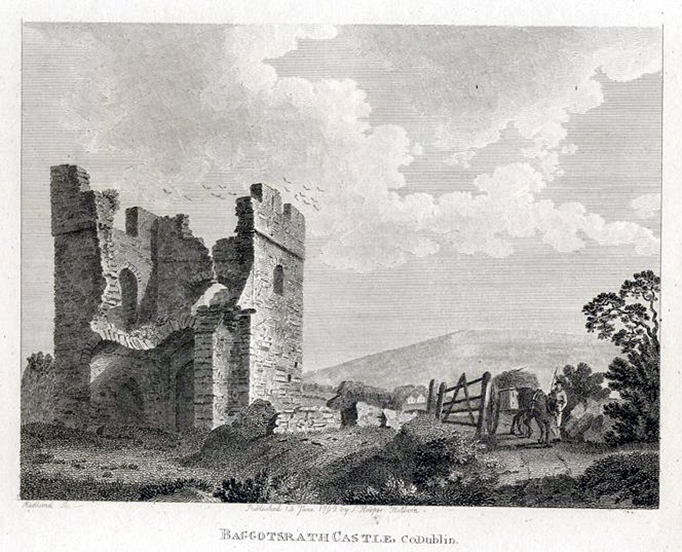
Baggotrath Castle, 1792.
Printed in [Grose, 1794].
See original.
Scan from here.
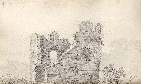
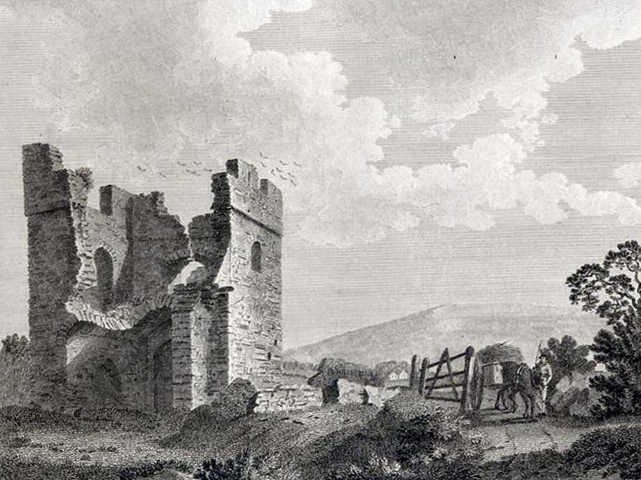
Baggotrath Castle.
Sketch by James Henry Brocas, early 19th century.
From NLI.
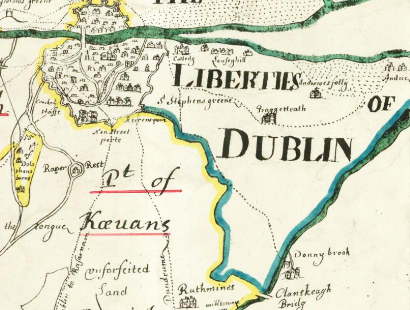
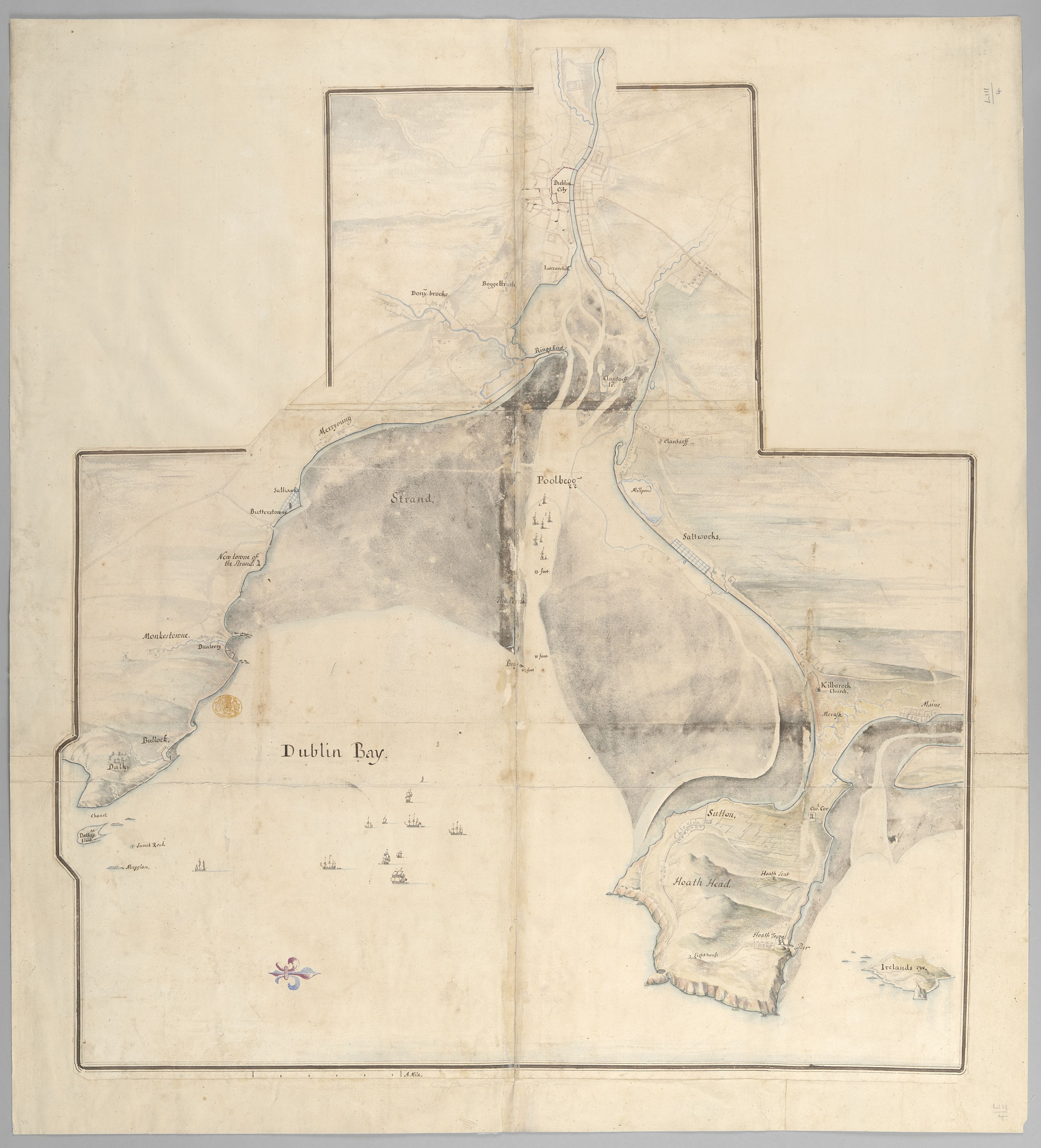
Baggotrath and Donnybrook on
Map of Dublin bay, 1685.
E (sea) is down.
See full size.
Location of Baggotrath Castle.
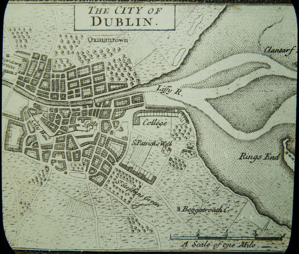
Herman Moll's map of Dublin, 1714.
NAI
is wrong to say this is
John Speed, 1610.
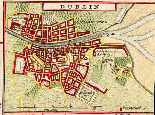
Herman Moll's map of Dublin, 1714.
Other version from Dublin City Public Libraries.
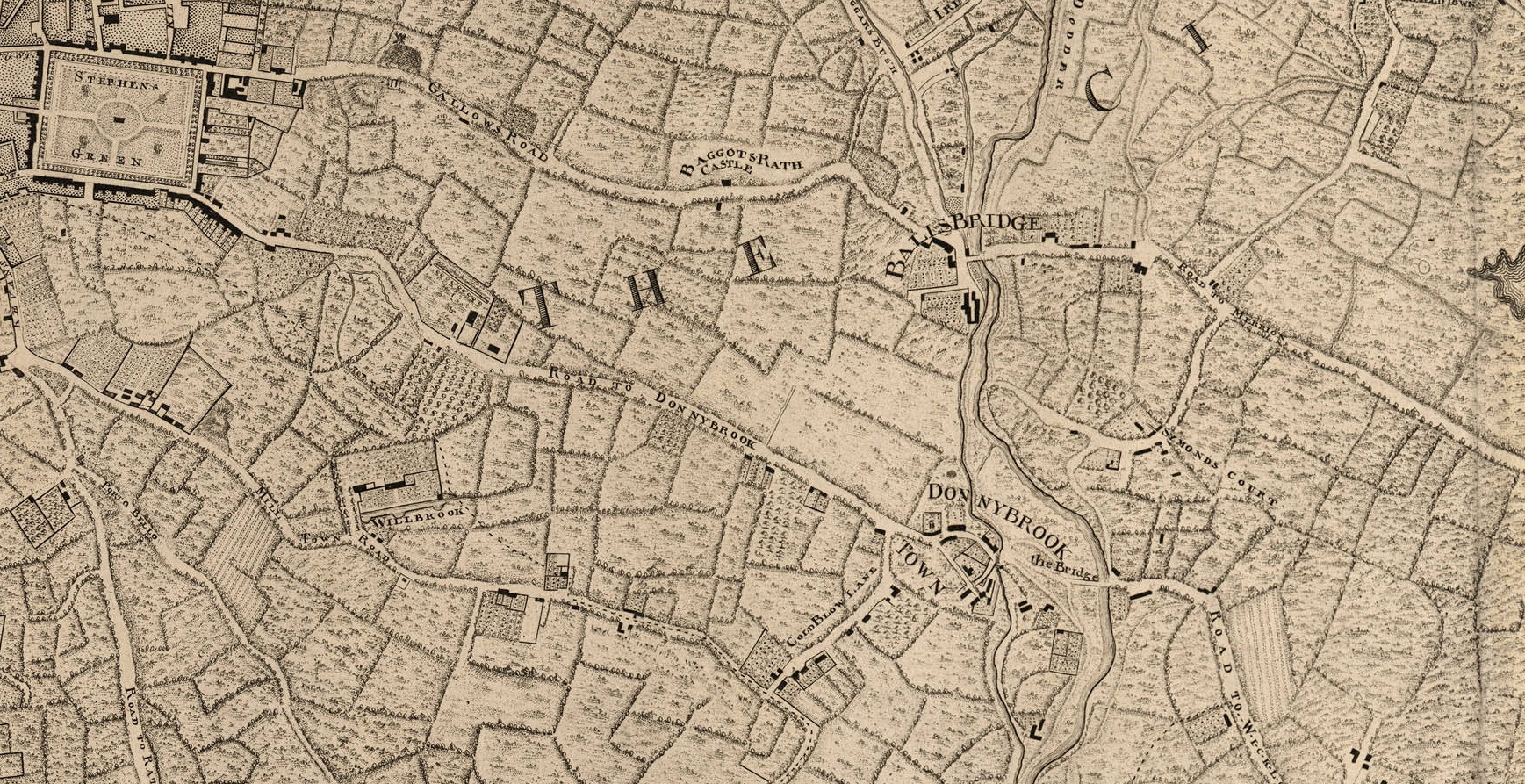
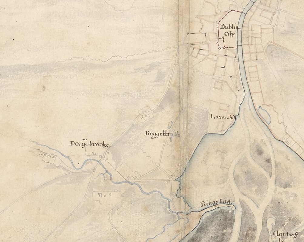
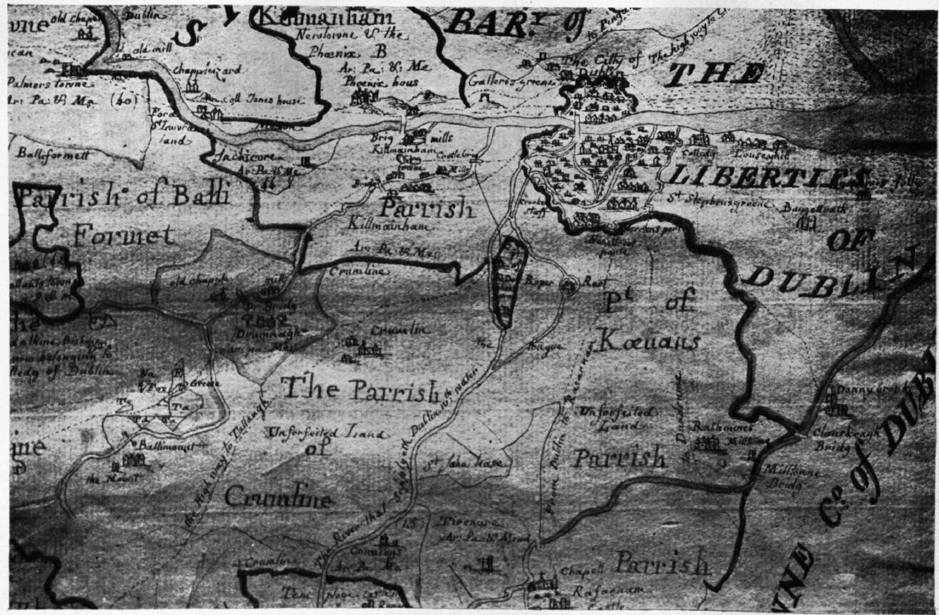
Detail of
John Rocque's map of Dublin, 1757,
showing Baggotrath, Simmonscourt and Donnybrook.
See larger.
Baggotrath Castle
is on the "Gallows Road", from Stephen's Green to Ballsbridge
(this became Baggot St and Pembroke Rd).
This map has Baggotrath Castle quite close to Ballsbridge (in the modern Pembroke Rd area).
But this may not be totally accurate.
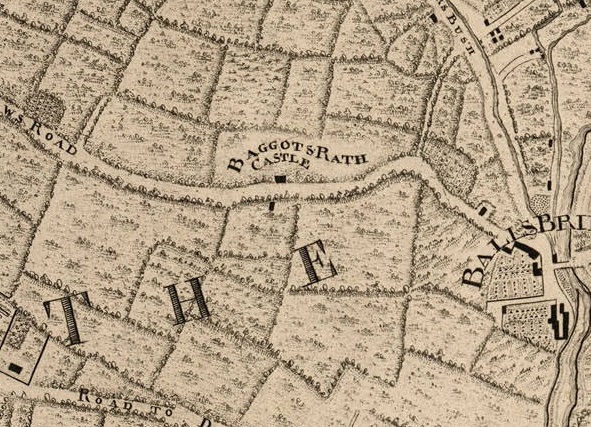
Detail of 1757 map above.
Baggotrath Castle was in open country, between Stephen's Green and Ballsbridge.
The castle was a ruin by this time.
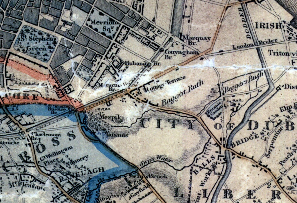
Baggotrath on Duncan's map of 1821.
From South Dublin Historical Mapping.
It is unclear if Baggotrath Castle still exists, or this is just the name of the location.
If the ruin of the castle still exists here, it is shown closer to the city than Rocque, near the canal, near modern Waterloo Road.
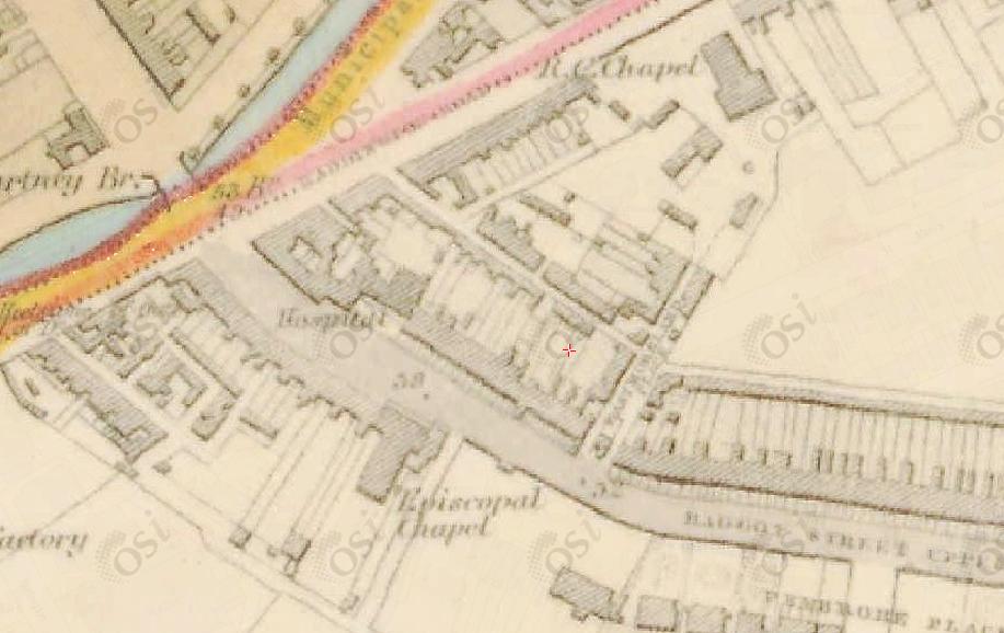
From 1829 to 1842 map.
Baggotrath Castle is vanished.
The site is about where the red cross is.
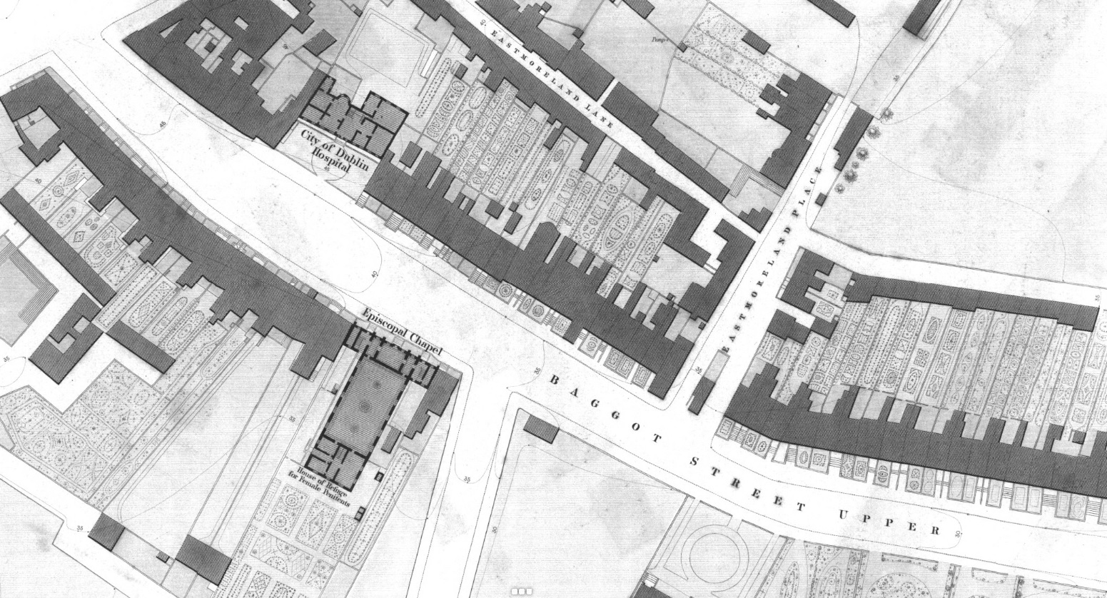
Ordnance Survey of Ireland map.
Date created: 1838.
Date modified: 1847.
From here.
Baggotrath Castle is vanished.
The site is thought to be just to the left of Eastmoreland Place.
The site above is now opposite Waterloo Rd.
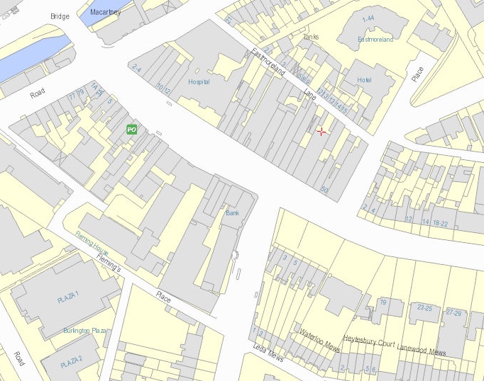
From modern map.
Wikipedia
says the site would be
"at the present 44-46 Upper Baggot Street, facing Waterloo Road"
(see street view)
but it is unclear what the source is.
Please donate to support this site.
I have spent a great deal of time and money on this research.
Research involves travel and many expenses.
Some research "things to do"
are not done for years, because I do not have the money to do them.
Please Donate Here
to support the ongoing research and
to keep this website free.
