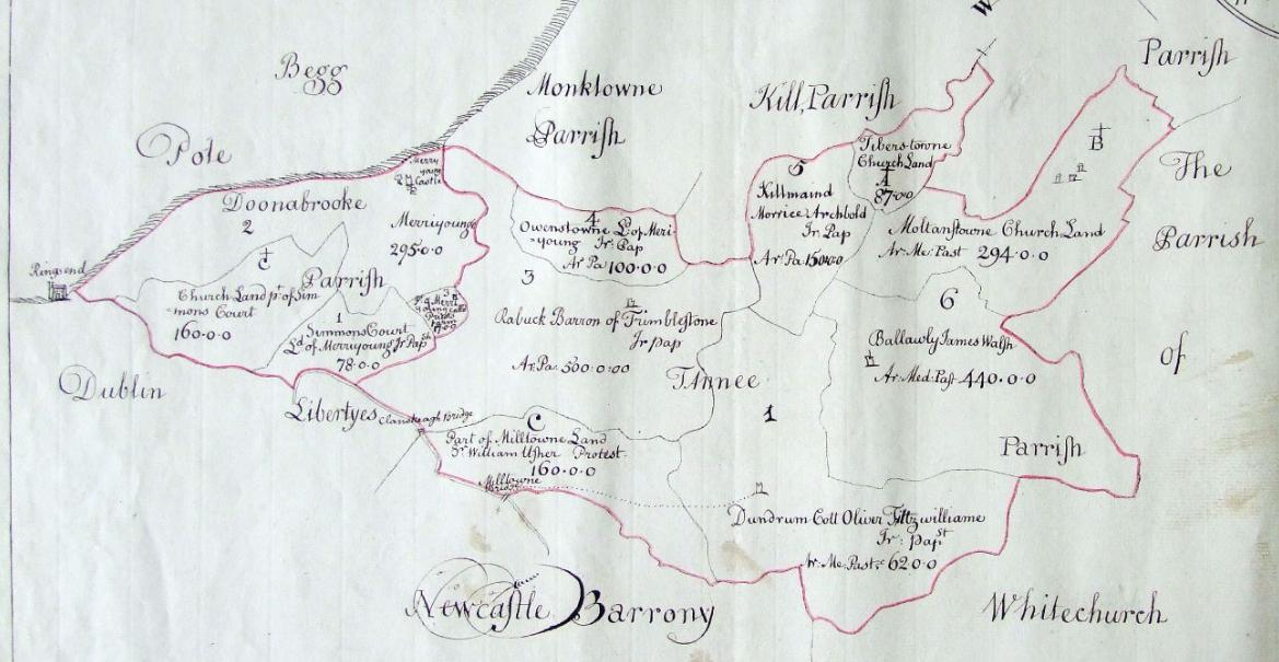
As you go up the E Avenue (up the hill, heading W, heading inland), you have:
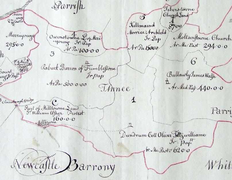
Part of the parish of Taney
in the
[Down Survey, 1655 to 1658].
E (sea) is up.
1st Viscount Fitzwilliam
holds
Owenstown (plot 4, this is Mount Merrion).
2nd Viscount Fitzwilliam
holds
Dundrum (plot 1).
Merrion Castle
and the sea are visible in top left.
This is part of the larger map of
Donnybrook and Taney.
From
TCD.
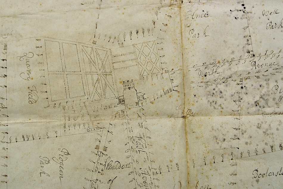
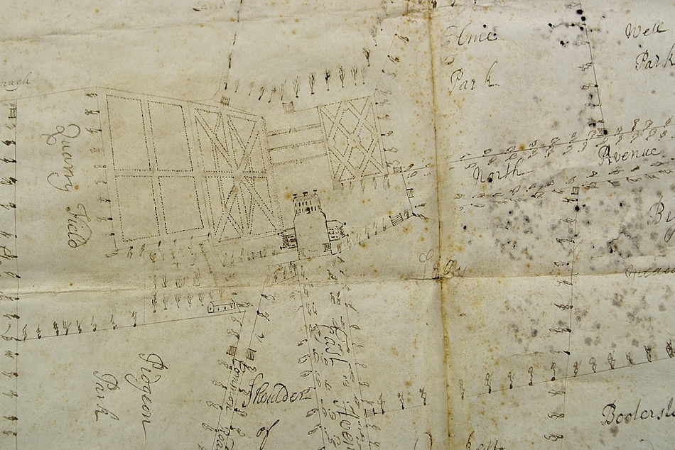
Original plan, not fully carried out, for Mount Merrion
to consist of blocks entirely surrounding the top of the avenue.
See original.
From Mount Merrion 300.
Used with permission.
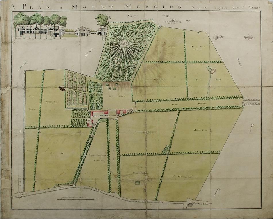
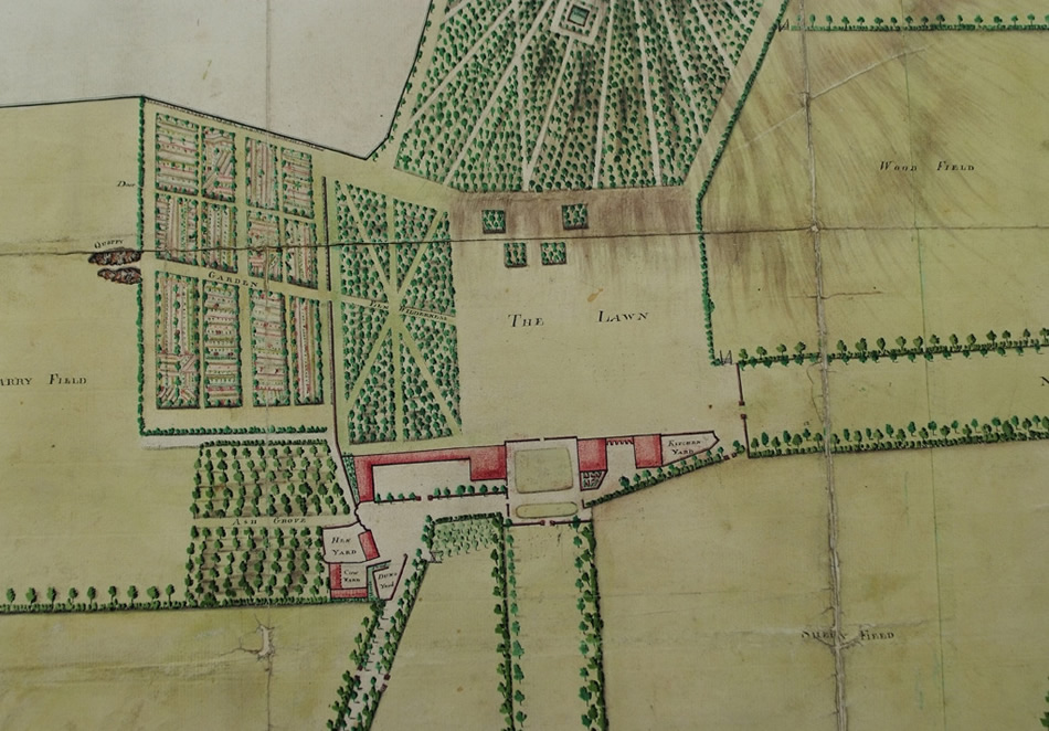
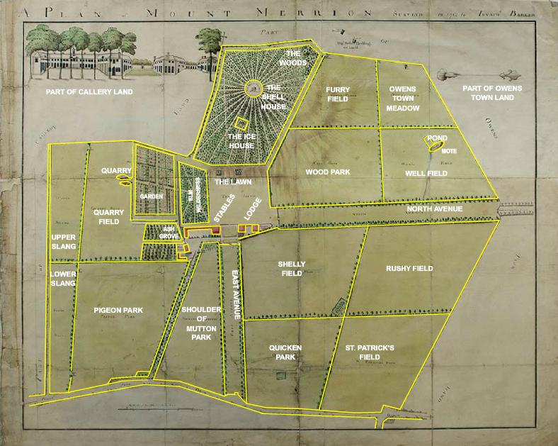
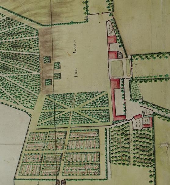
Map of Mount Merrion House and estate, by Jonathan Barker, 1762.
N is to the right.
Clearly showing the front (E) avenue (now Sycamore Crescent)
and also the N avenue.
See original PNG.
From Mount Merrion 300.
Used with permission.
Overlay of Barker's map of 1762 with map of 1949.
Click through to an old format SWF file, which may or may not play on your browser. Either way, it is safe!
From
Mount Merrion 300.
Used with permission.
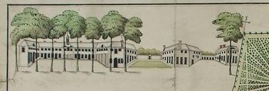
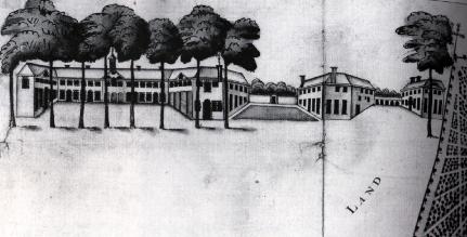
Sketch of Mount Merrion House, 1762.
Drawn in top LHS corner of Barker's map.
Seems to show 3 closely interconnected blocks,
but think middle wall should be drawn long and thin
to span a real gap in the middle.
From Mount Merrion 300.
Used with permission.
See black and white scan.
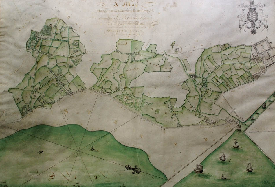
Part of Pat Roe's map of the Fitzwilliam estate, 1774.
Shows Mount Merrion, Blackrock, Booterstown.
See full size.
See smaller map of whole estate.
From Mount Merrion 300.
Used with permission.
Original in [Pembroke estate papers].
Mount Merrion House.
Detail of Pat Roe's map of 1774.
Note the stables are not symmetrical. The RHS stable block is bigger.
Mount Merrion Ave has now been completed to join the Stillorgan Rd.
From Mount Merrion 300.
Used with permission.
Original in [Pembroke estate papers].
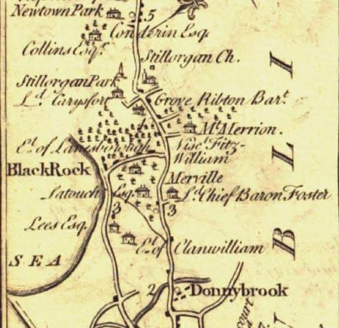
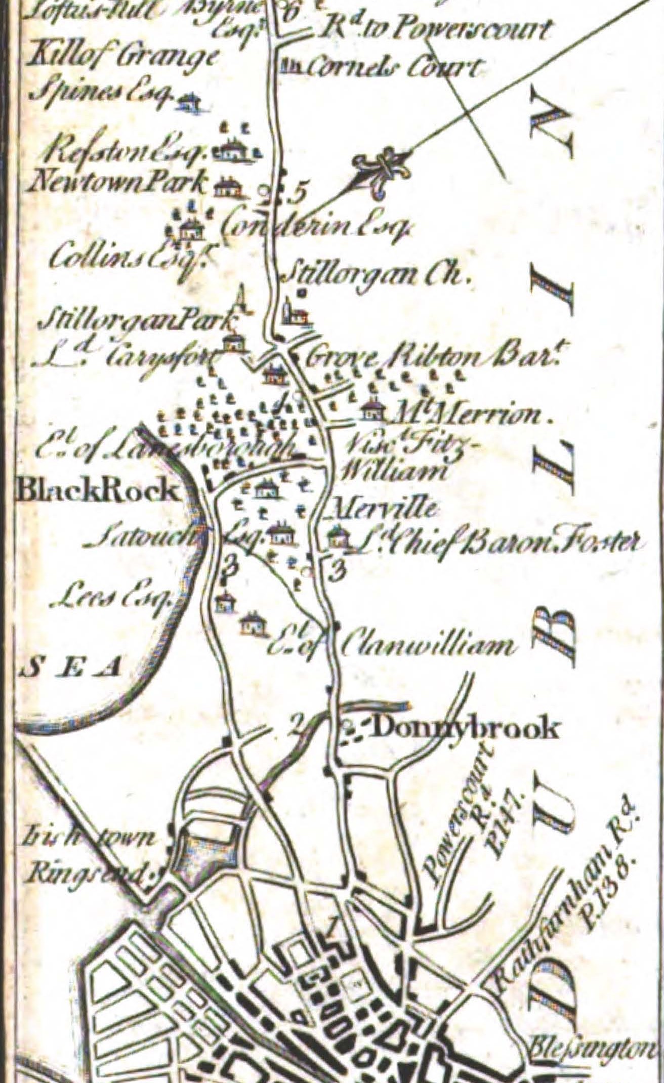
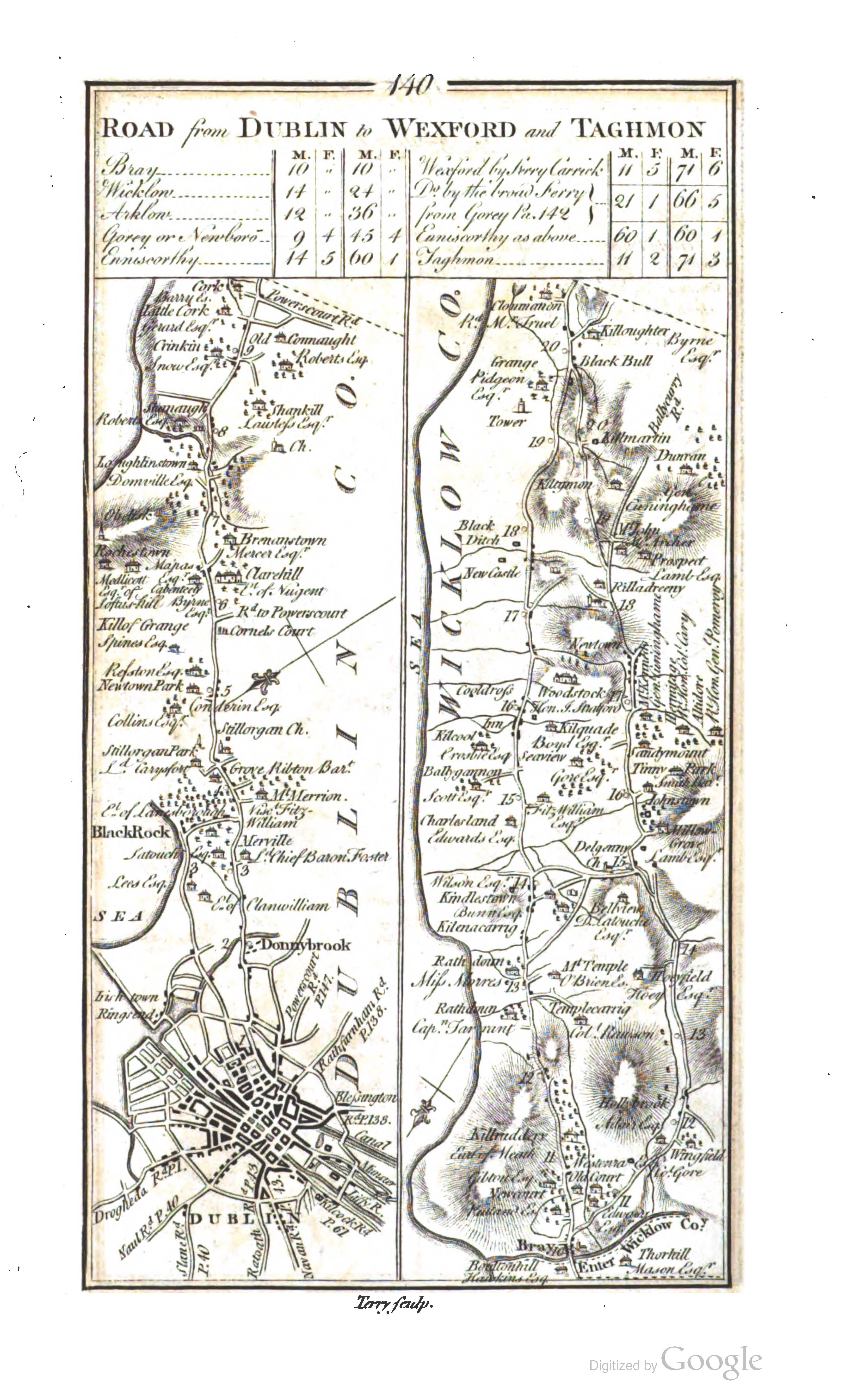
Mount Merrion on the
Dublin to Wexford road in 1777.
Up is South.
Page 140
in
[Taylor and Skinner, 1777].
See other scan
(and full size).
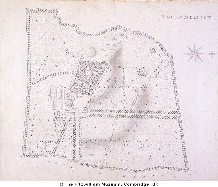
Map of Mount Merrion House and estate, 1806, by William Ashford.
N is to the right.
Clearly showing the front (E) avenue
and also the N avenue.
Stillorgan Rd at bottom.
Used here with the kind permission of the
Fitzwilliam Museum, Cambridge.
Mount Merrion on
1829 to 1842 map.
This map is a bit inaccurate.
It does not show the second (diagonal) avenue up to the house,
which appears on both earlier and later maps.
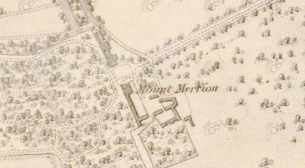
Mount Merrion House on 1865 map.
Note the stables are not symmetrical. The RHS stable block is bigger.
From Mount Merrion 300.
Used with permission.
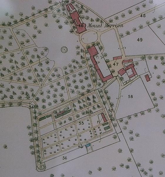
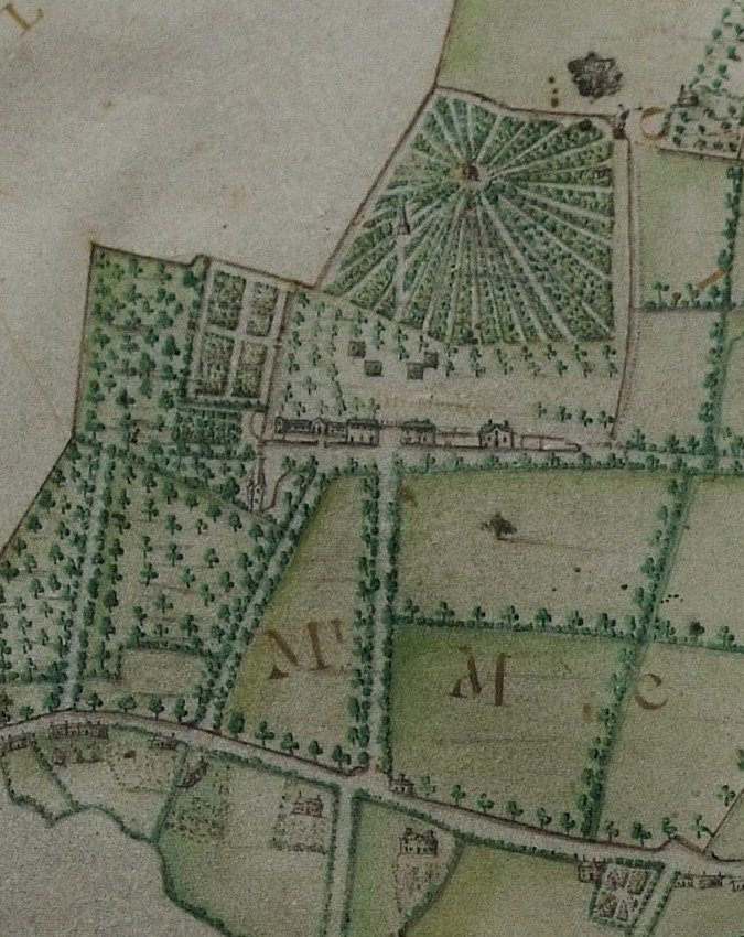
(Left) The buildings (detail from Barker's map, 1762, rotated so North is up).
Clearly shows the old garden wall, to the SW of the stables.
(Right) The area, 1865.
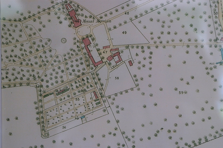
Mount Merrion on
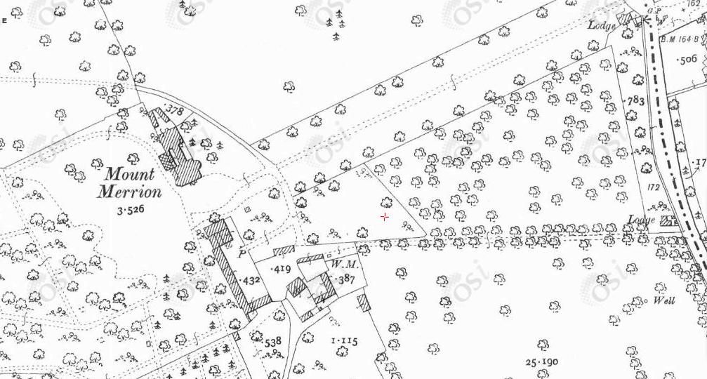
1887 to 1913 map.
Note the stables are not symmetrical. The RHS stable block is bigger.
Mount Merrion on 1939 map.
Please donate to support this site.
I have spent a great deal of time and money on this research.
Research involves travel and many expenses.
Some research "things to do"
are not done for years, because I do not have the money to do them.
Please Donate Here
to support the ongoing research and
to keep this website free.
