Newtown House, Tallaght
Newtown House,
Newtown,
Tallaght townland
(just E of
Tallaght village),
Tallaght parish,
Co.Dublin.
The area around
Bolbrook Mill
was formerly known as Newtown.
Newtown House was
a 2 storey house,
just S off the old Tallaght Rd / Blessington Rd, down slope,
near the
River Dodder.
Robert Stubbs
listed there in
[Thom's, 1847].
His son
William Stubbs
listed there in
[Thom's] 1861 to 1912.
Agnes Flanagan
married 1866 to William Stubbs
and they lived at Newtown.
Her father
William Flanagan
died at Newtown 1874.
William Stubbs
died at Newtown 1912.
Robert Stubbs
listed there in
[Thom's] 1913 to 1926.
T. Curtis is listed at Newtown House in
[Thom's] 1927 to 1928.
It may be coincidence but
"Thomas Curtis" was living at the Flanagan property
Walkinstown House
in 1901.
Can't find Newtown House in
[Thom's]
1929 and after.
Maybe it was re-named.
[Liam Cosgrave]
thinks the Stubbs house was there in the 1960s.
Photo below suggests the house may have existed in 1978.
Think McMahon owned this land in 1970s.
The Stubbs house seems to be plot 10B
I think plot "10B" on the map below is the Stubbs house, Newtown House.
Reasons to think this:
- The Griffiths Valuation maps do not match the plot numbers in the text.
But looking around, the only large house in this area apart from the mill seems to be plot 10B.
- [Liam Cosgrave]
said the Stubbs house was just S off the old Tallaght Rd,
some distance E of the modern location of Newtown Park.
-
Page 131
of the chapter
"The River Dodder"
of
[Handcock, 1899]
says:
"the mill-race ... is used in working the Boldbrook Cardboard and Packing Paper Mills, belonging to the Messrs. Boardman. Here it is joined by the Tallaght Brook, and soon after it flows into the main stream"
[the River Dodder]
"under Mr. Stubbs's farm."
This matches exactly with where we think Newtown House is below.
There are no other houses nearby which could be Stubbs's farm. This is the only one.
More confirmation is perhaps needed
(e.g. by looking at deeds).
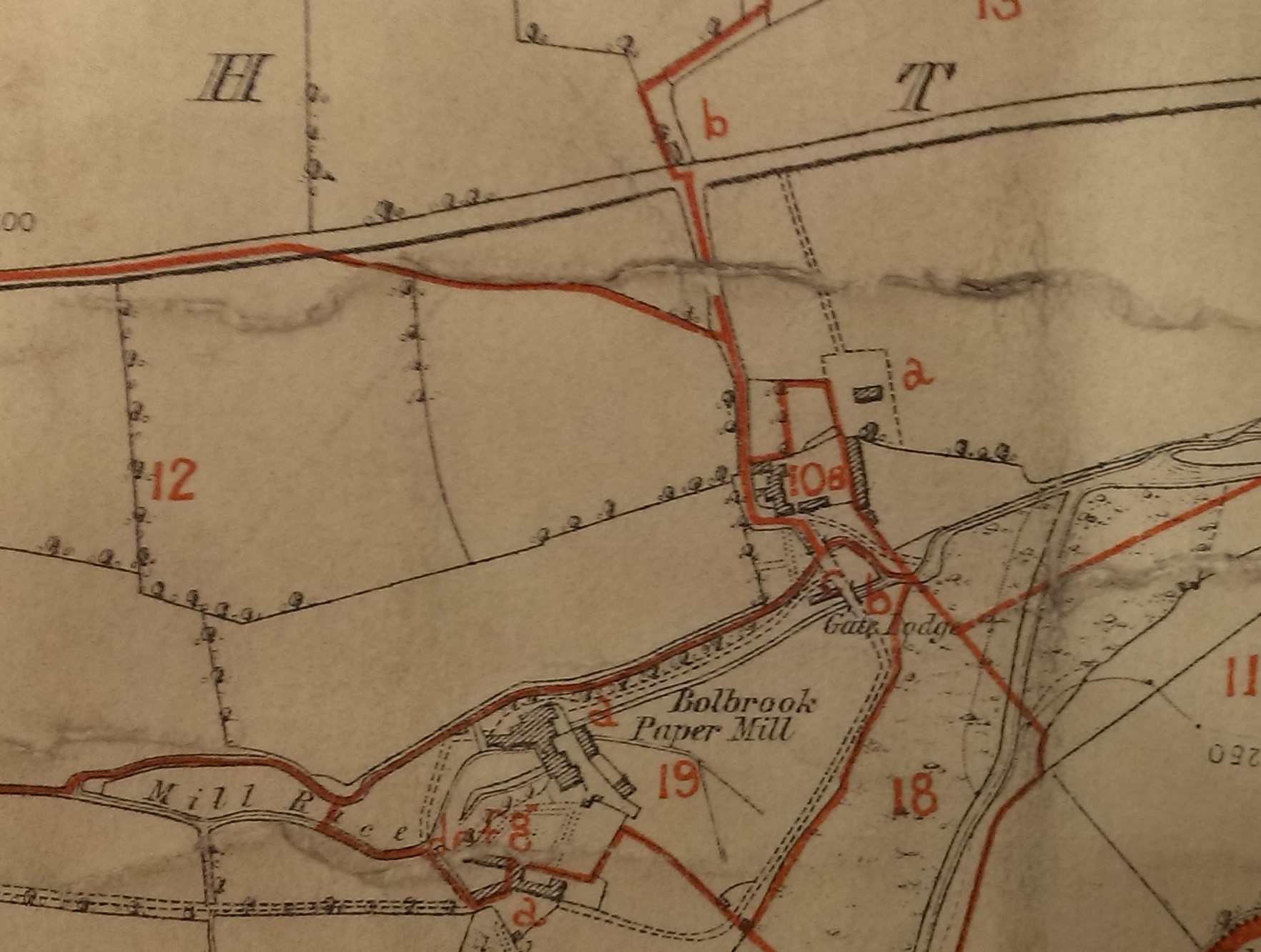
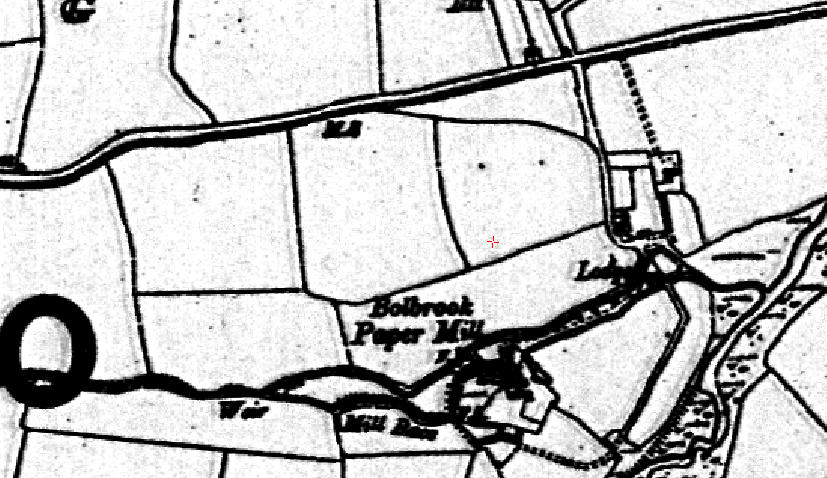
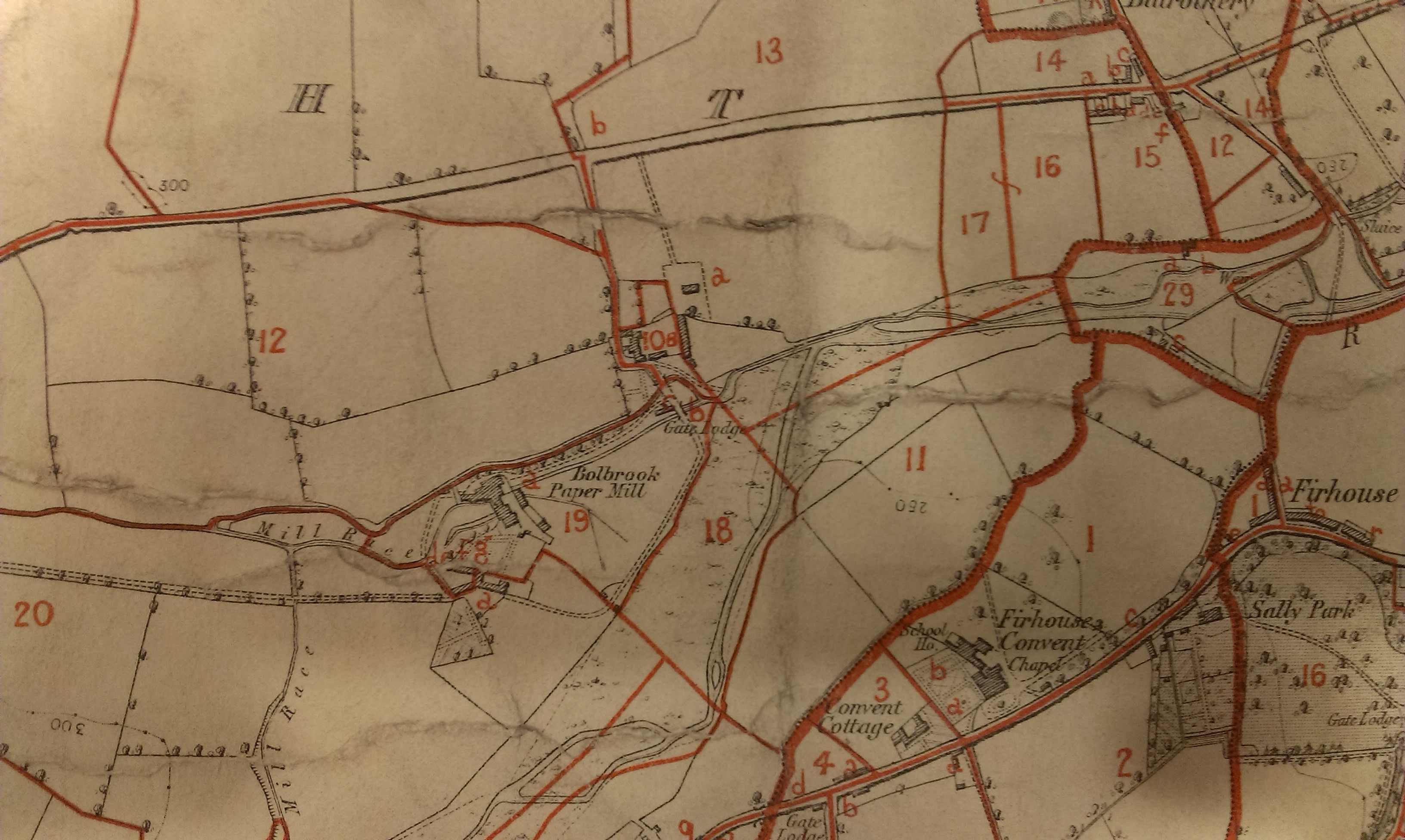
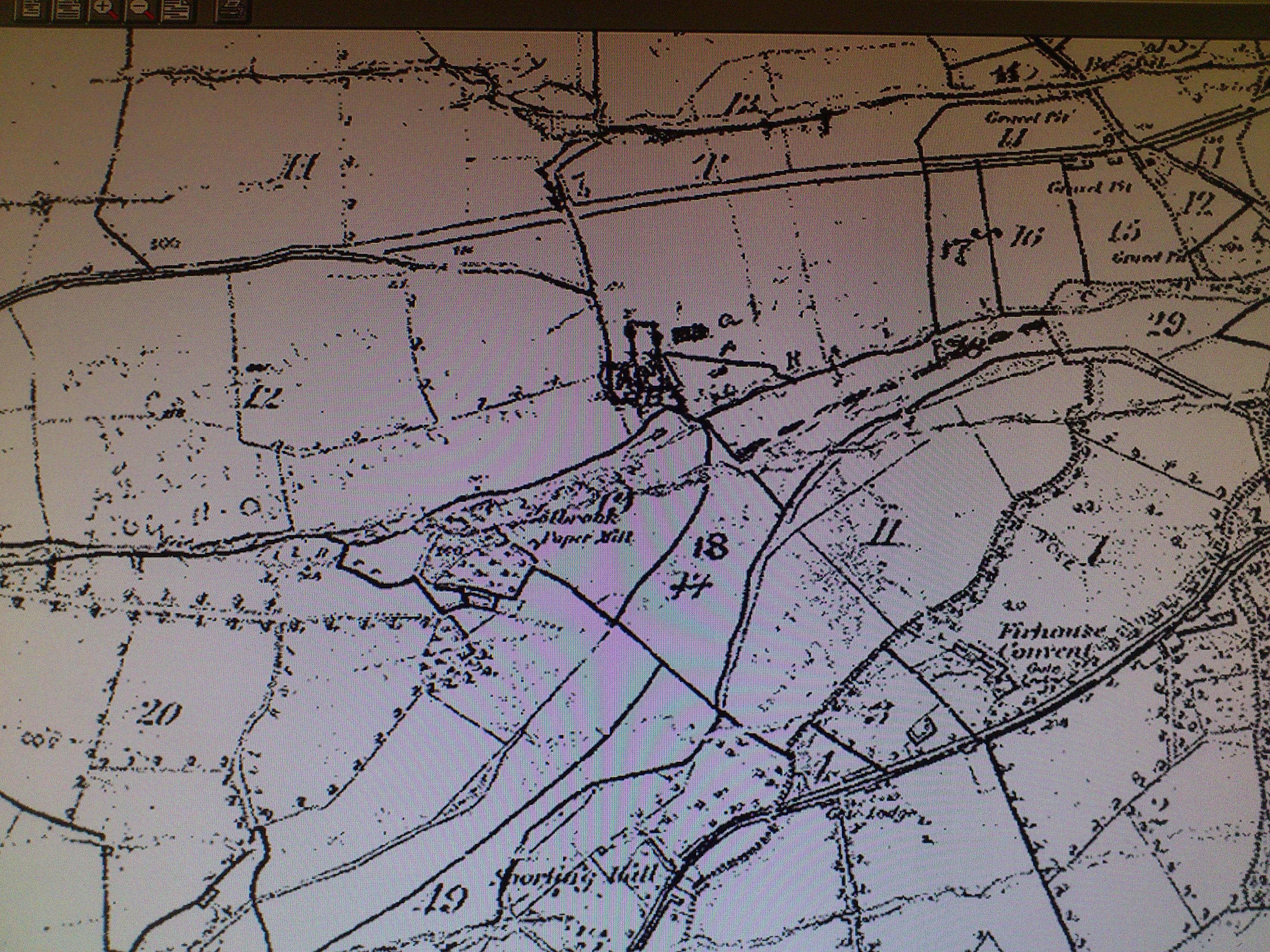
The area around Bolbrook Mill, just E of Tallaght village.
On map in
[VO]
of unclear date.
See
full size.
Unfortunately, the plot numbers do not match either
[Griffiths Valuation, 1847]
or
[Griffiths Valuation, 1850].
[VO] Griffiths Valuation maps, Dublin county,
map 22,
does not match the plot numbers either.
-
For example, the mill is plot 18 in both years of Griffiths,
but on both maps it is 19.
-
Likewise, in both years of Griffiths
the large Stubbs house is plot 11, which has no house on these maps.
-
Robert Stubbs
is listed in [Griffiths Valuation, 1847]
as holding
plots 11, 15 and 51.
Plot 11 has a large house and 129 acres.
In [Griffiths Valuation, 1850]
he holds plots 9, 10, 11 and 12.
Plot 11 has a large house and 44 acres.
Neither of these match these maps.
Conclusion: Despite the plot numbers not matching,
I think the Stubbs house is plot 10B.
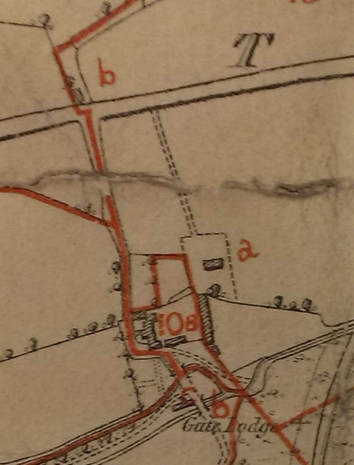
Close-up of what must be the Stubbs house, Newtown House,
at plot 10B.
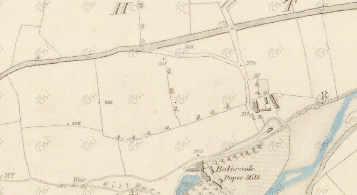
Think this is Newtown House, just NE of Bolbrook Mill.
From
1829 to 1842 map.
See full size.
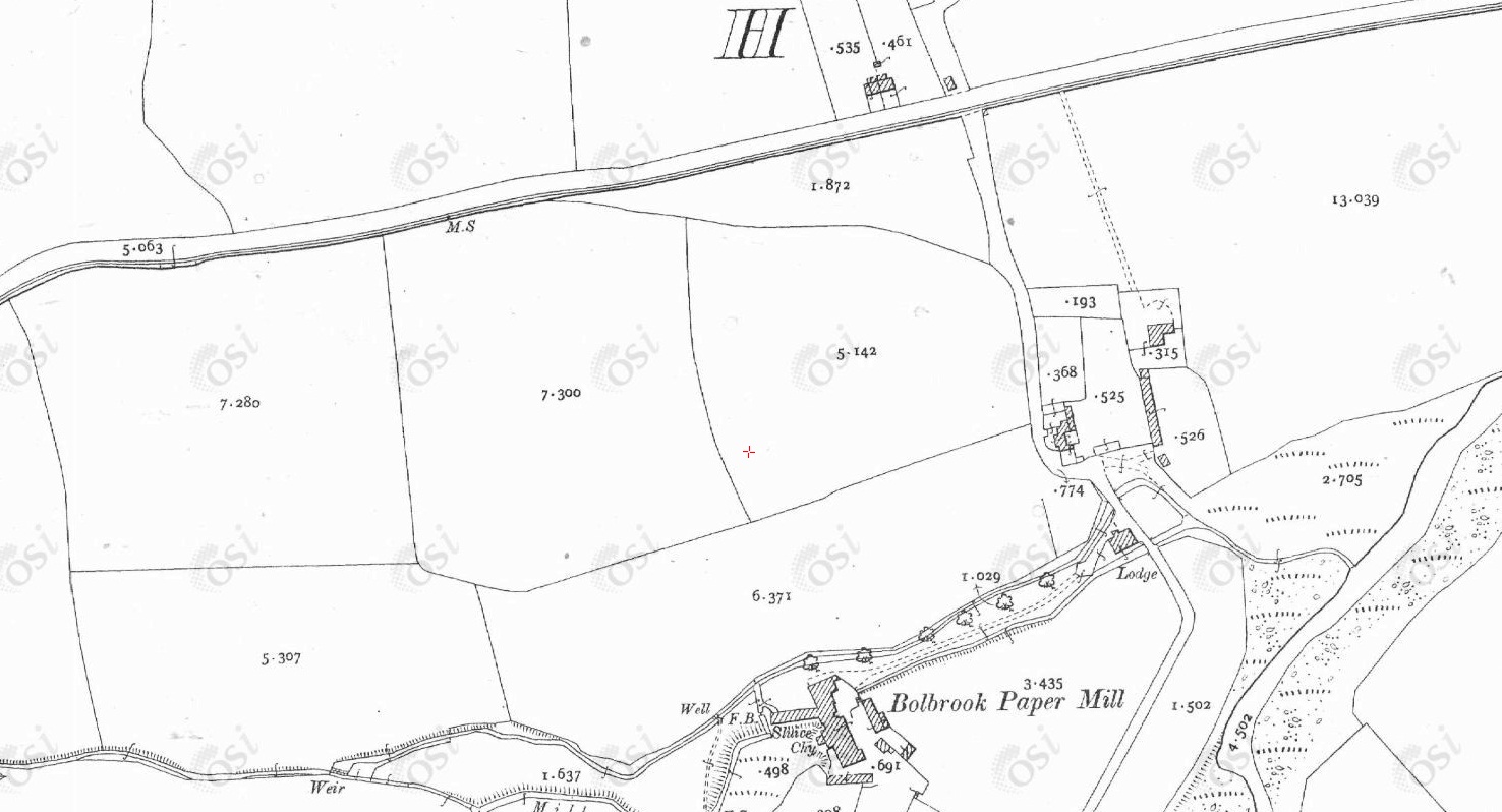
Think this is Newtown House, NE of Bolbrook Mill.
From
1887 to 1913 map.
See full size.
In 1901 census,
William Stubbs' house
Newtown House
is listed as having 5 rooms, 5 windows in front of house, 9 out-buildings.
In 1911 census it
is listed as having 6 rooms, 5 windows in front of house, 9 out-buildings.
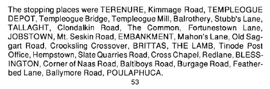
List of stops on the
Dublin and Blessington Steam Tramway
(which operated 1888 to 1932).
From
[Tallaght Trails, Tales and Walking Boots, 2009].
Also here.
Note that between Balrothery and Tallaght there is a stop at "Stubb's Lane".
Stubb's Lane is the road leading down to Newtown House above.
(There was no other junction between Balrothery and Tallaght.
See old map.)
Think this is Newtown House, NE of Bolbrook Mill.
From
1940 map.
From South Dublin Historical Mapping.
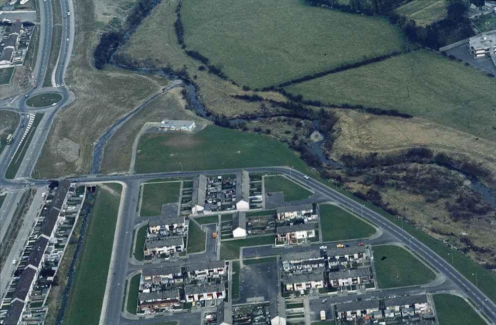
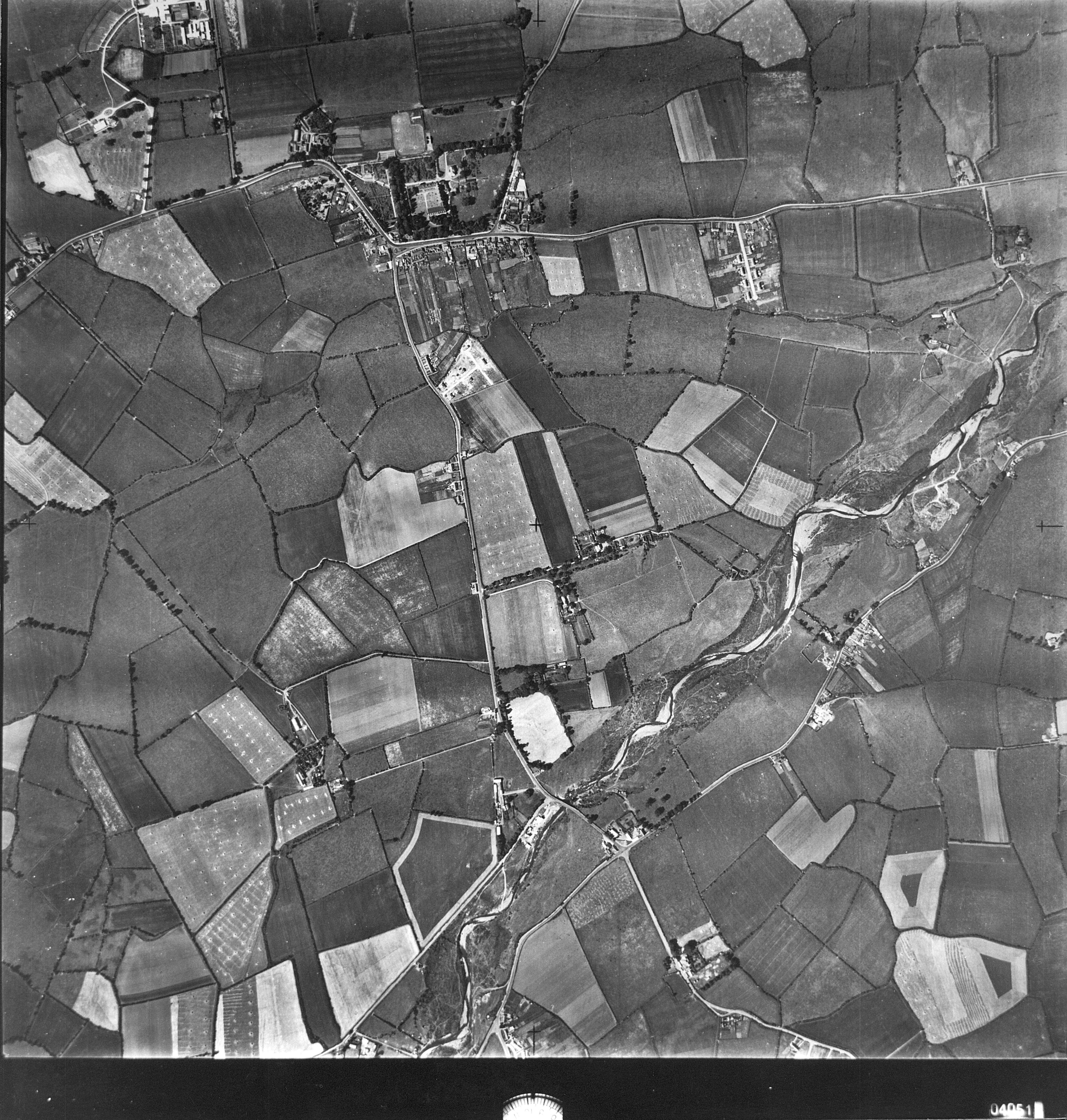
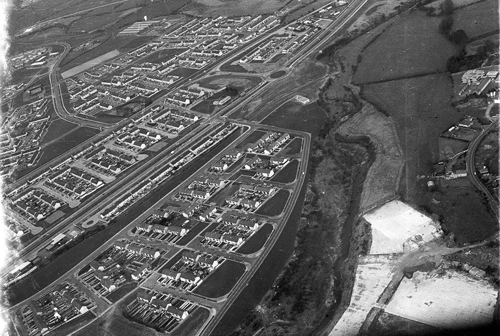
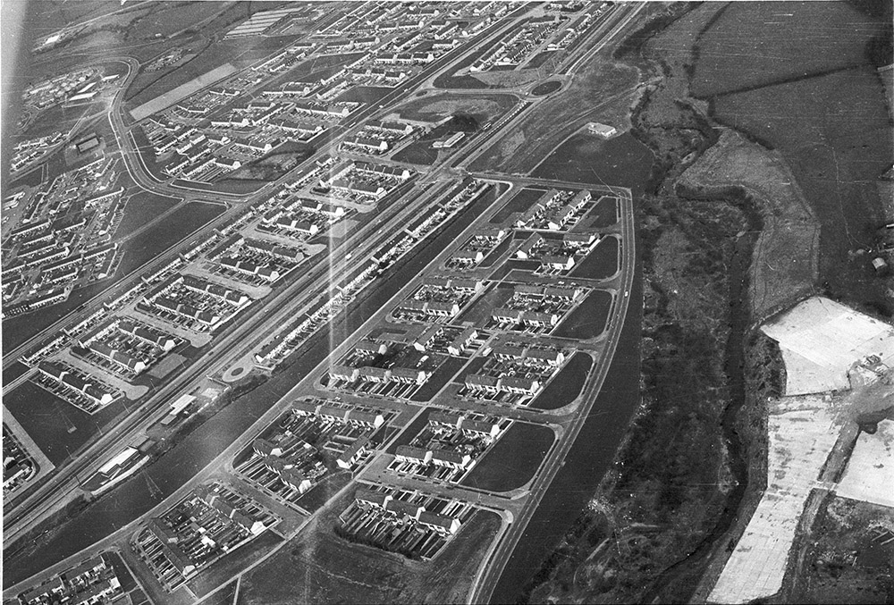
Aerial photo of 1973.
The stream, which is still there today, is visible here.
See larger
and full size.
From South Dublin Libraries Local Studies.
Also here.
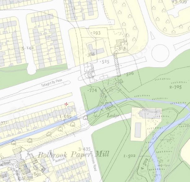
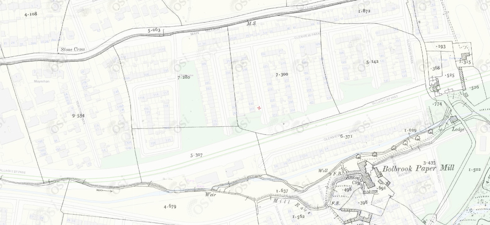
Overlay
of
1887 to 1913 map and
modern map shows the site entirely cleared.
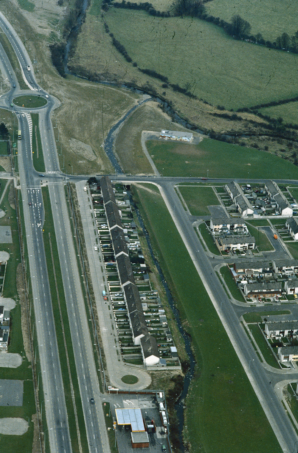
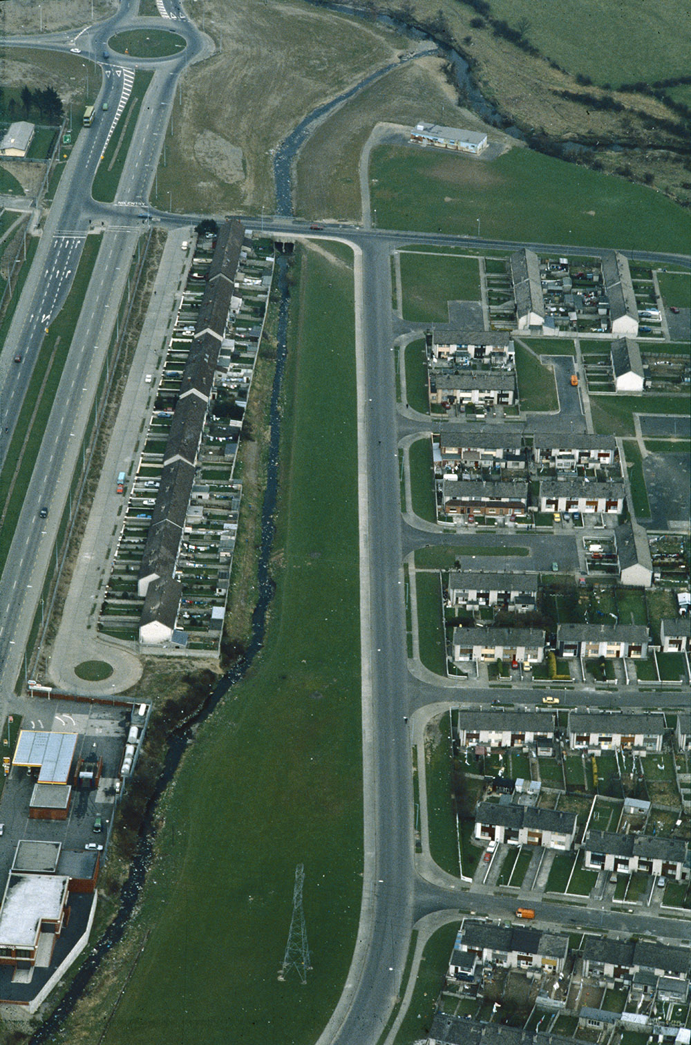
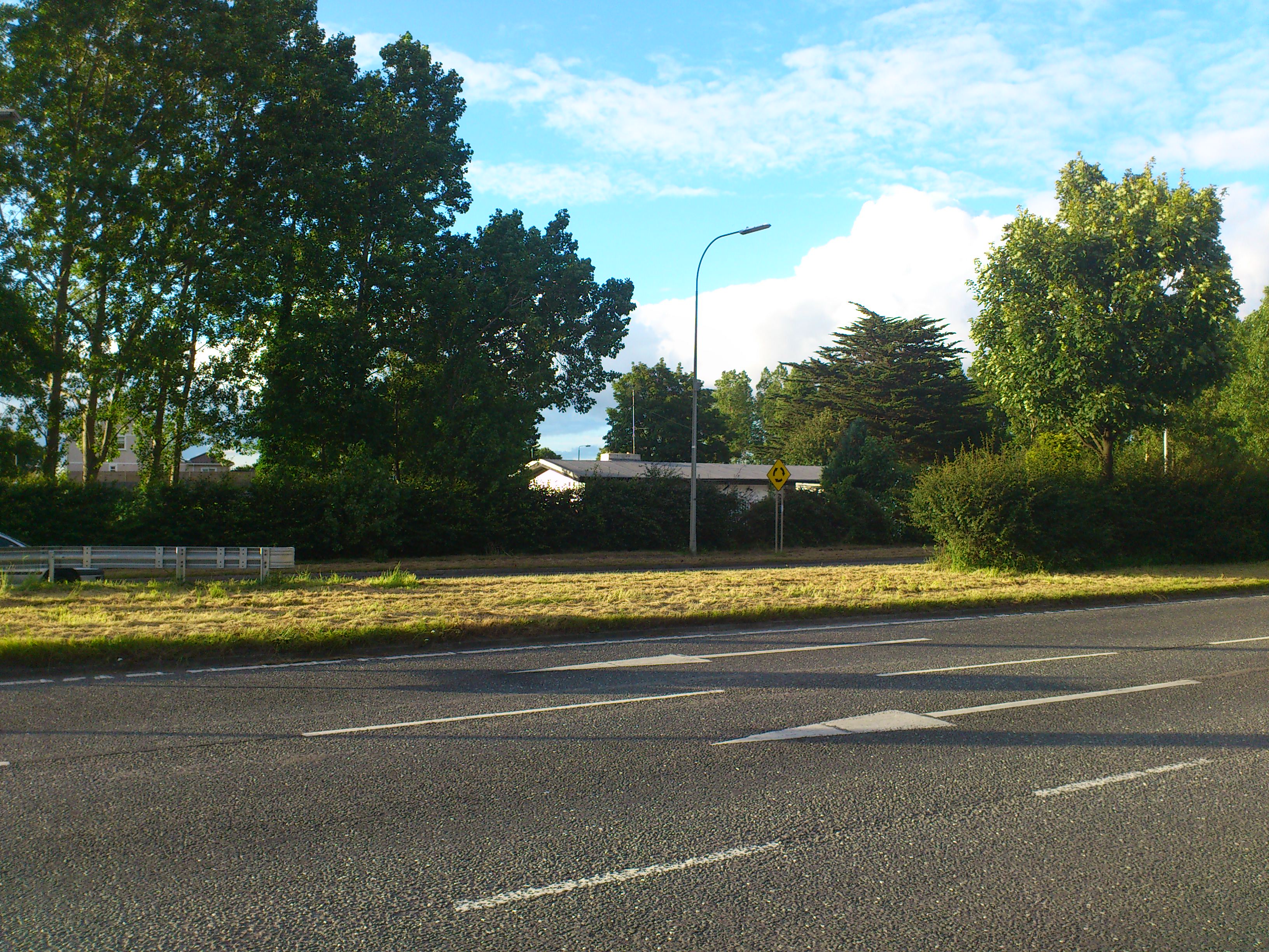
The apparent site of Newtown House is now covered by the Tallaght bypass.
Liam Cosgrave
said the modern bungalow on the N side of the bypass ("368" here)
was built on Stubbs' land.
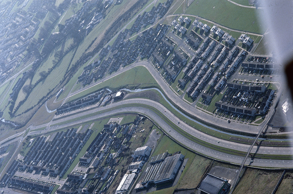
Late 20th century aerial photo.
Taken
after the site was cleared.
Leo Swan Archive.
Reference
LS_AS_35CT_00080_05m.
From here.
This and the following
are labelled as
"Oblique aerial photograph taken by Leo Swan of Tallaght, County Dublin."
The site above is completely cleared today.
Nothing is recognisable.
Newtown House would be where the Tallaght bypass
passes by Glenview Park and Avonmore Rd.
Click to drag.
From
Google Maps.
See
street view.
See
street view
of the modern bungalow on the N side of the bypass.

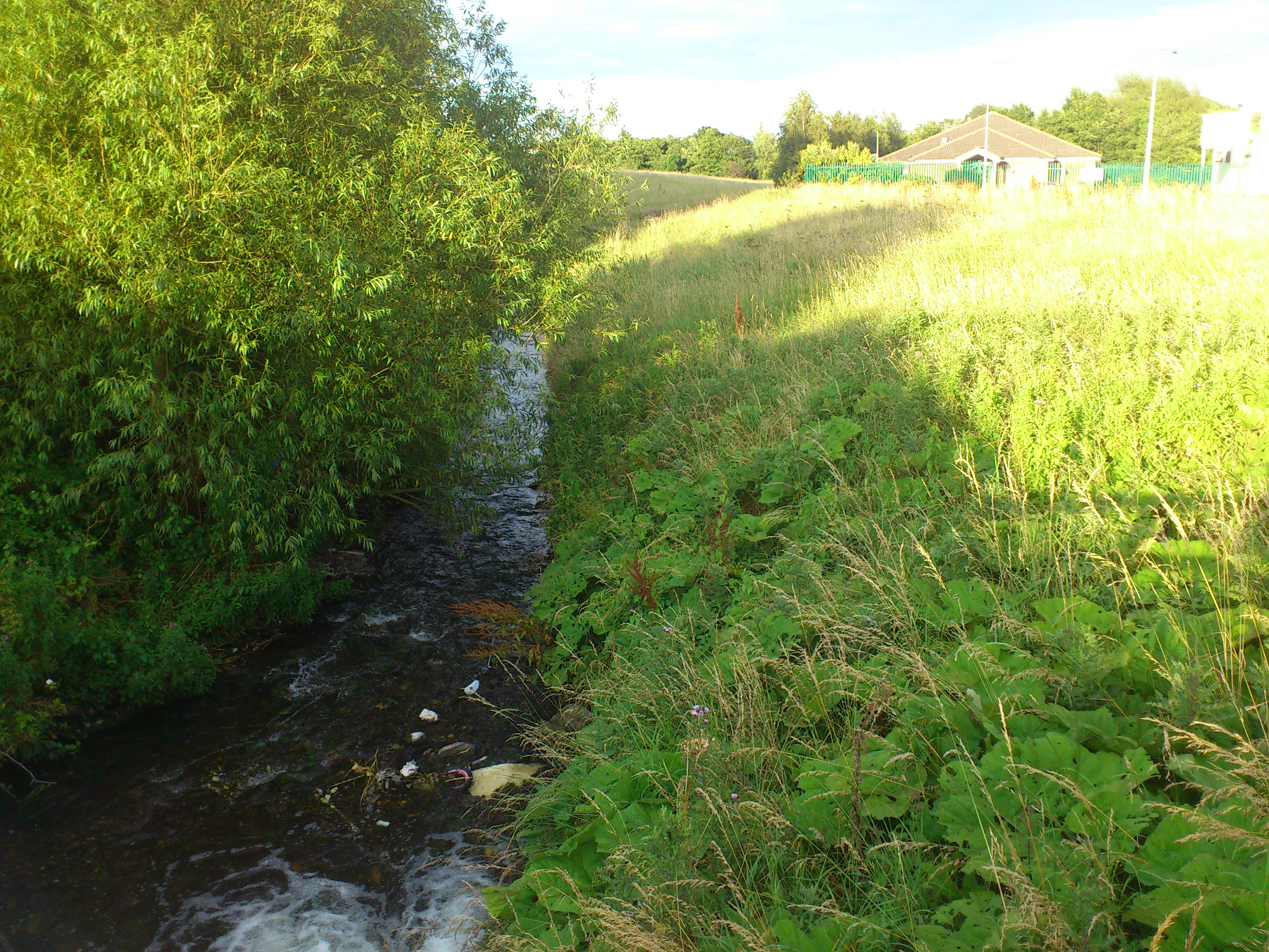
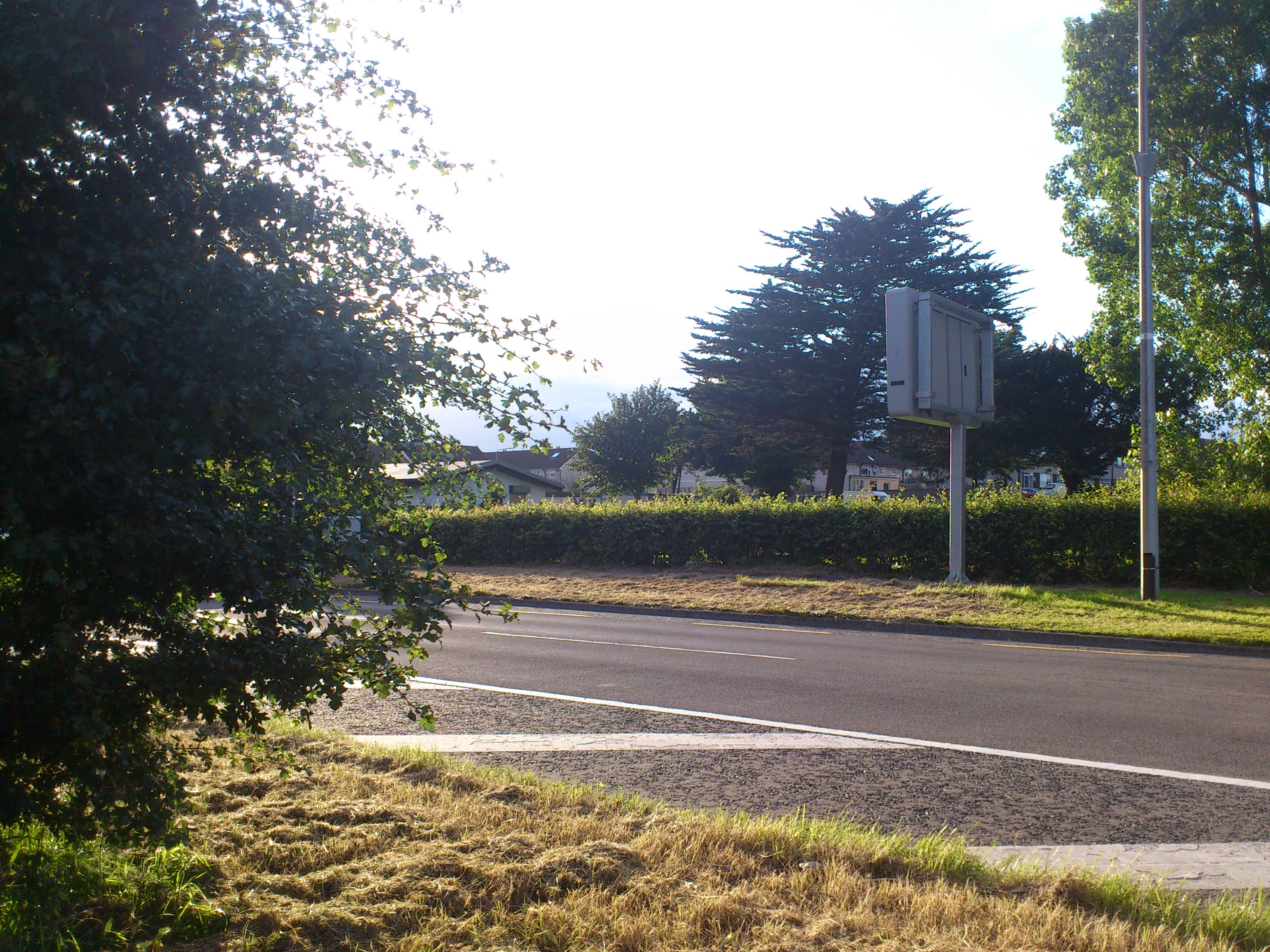
The stream running across the S of the site.
View from bridge looking E.
Photo 2012.
See full size.

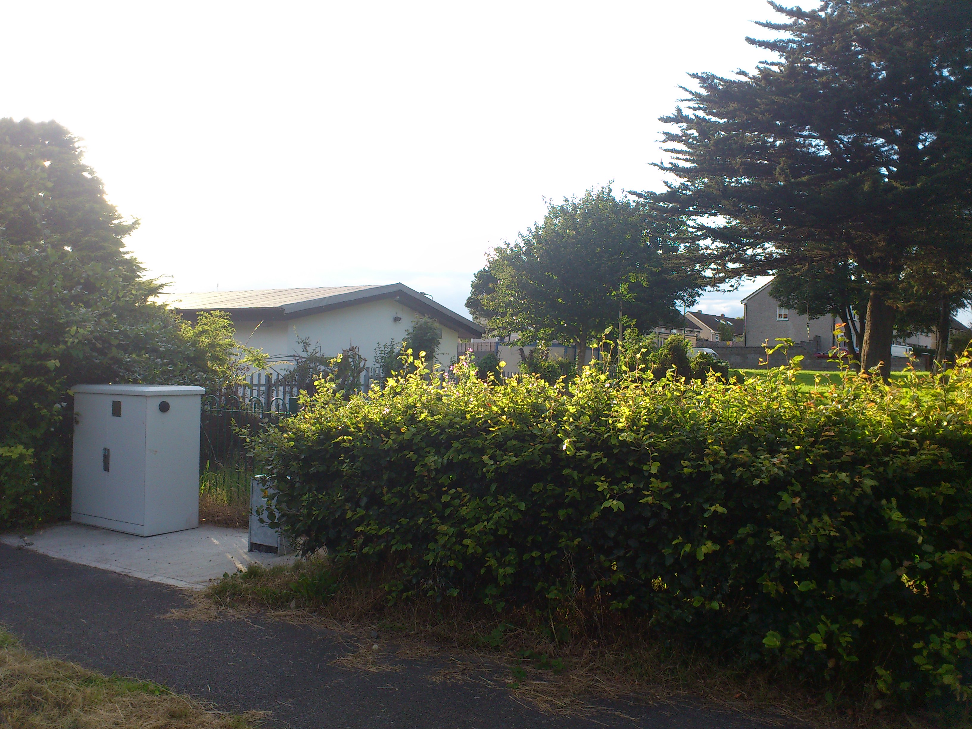
Photo of the site, from the bypass, looking N at the bungalow.
Photo 2012.
See full size
and wider shot
and other angle.
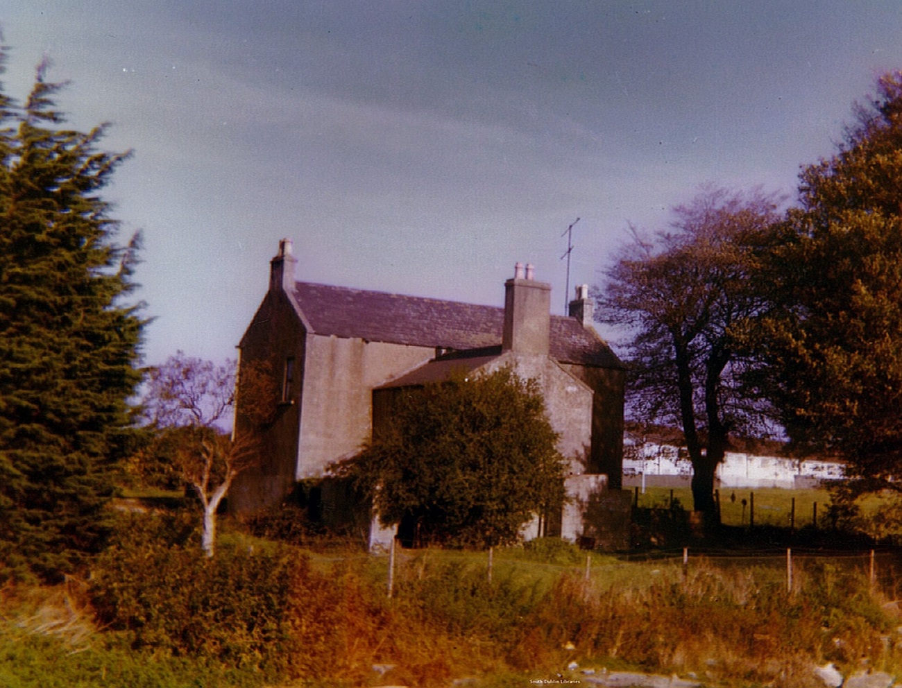
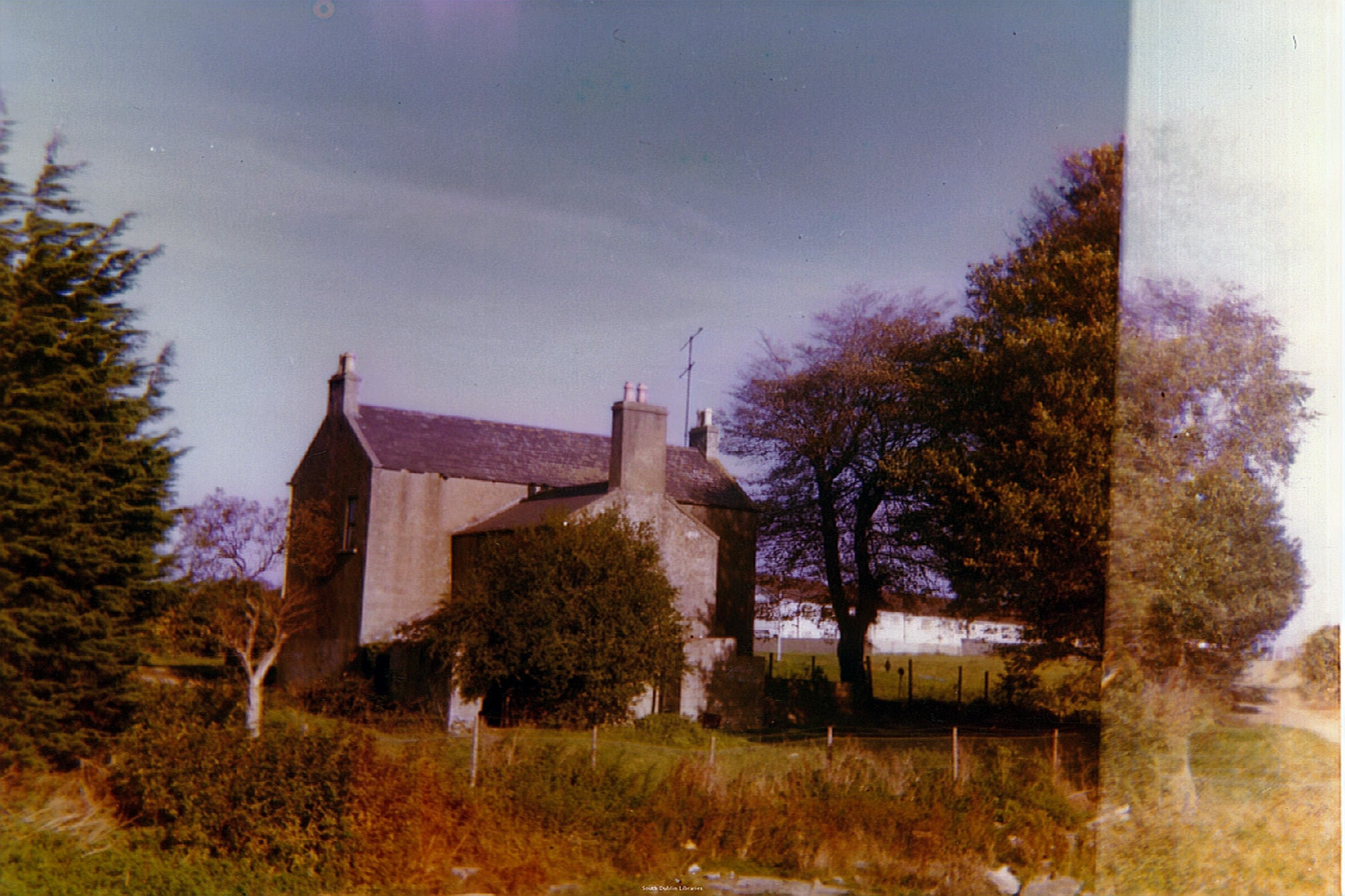
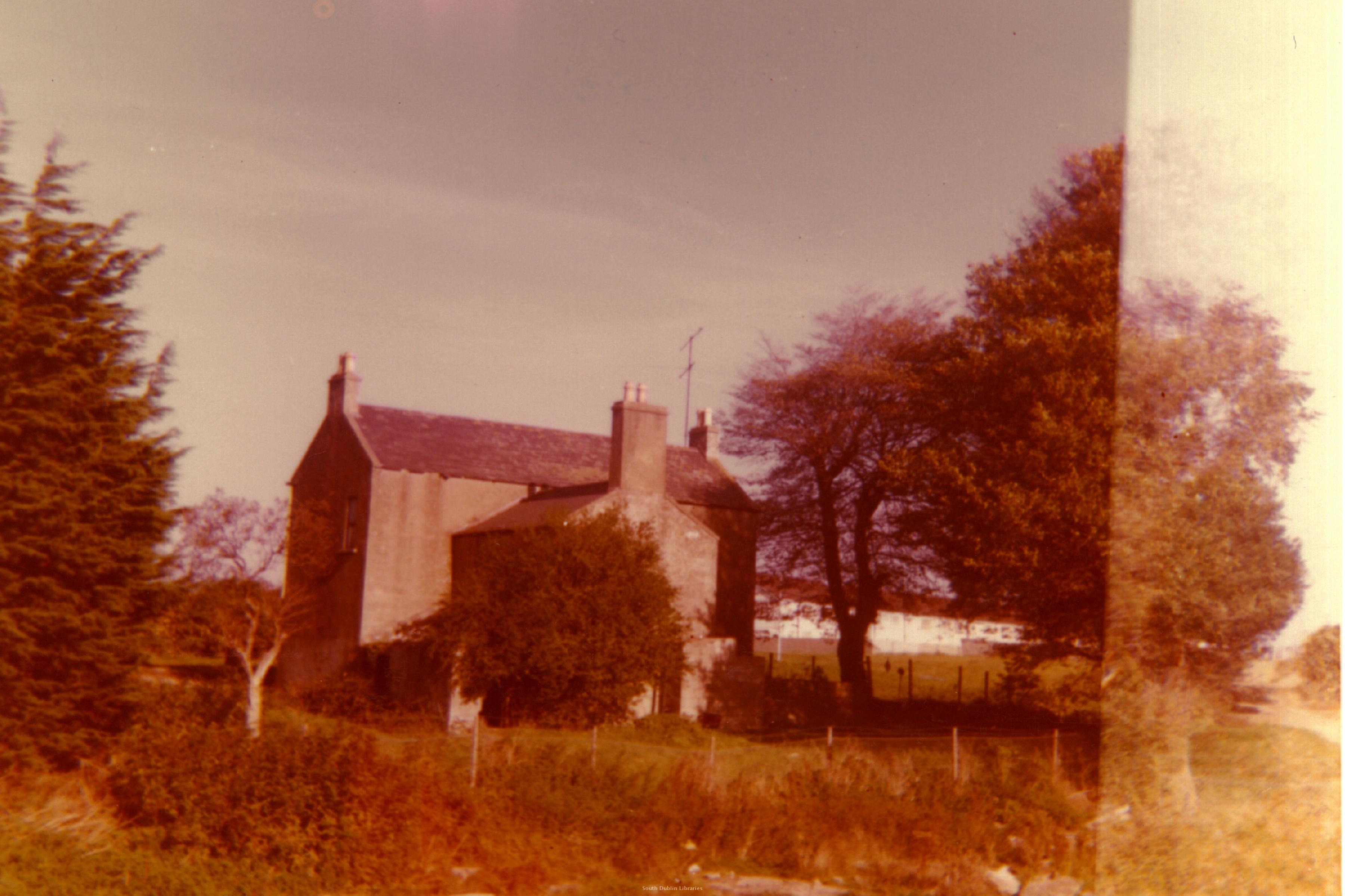
House at Bolbrook, E of Tallaght.
Photo 1978.
Clearly different to
Bolbrook Mill.
This may be
Newtown House.
Liam Cosgrave
said the Stubbs house was 2 storey,
and said this looks like it.
See
full size.

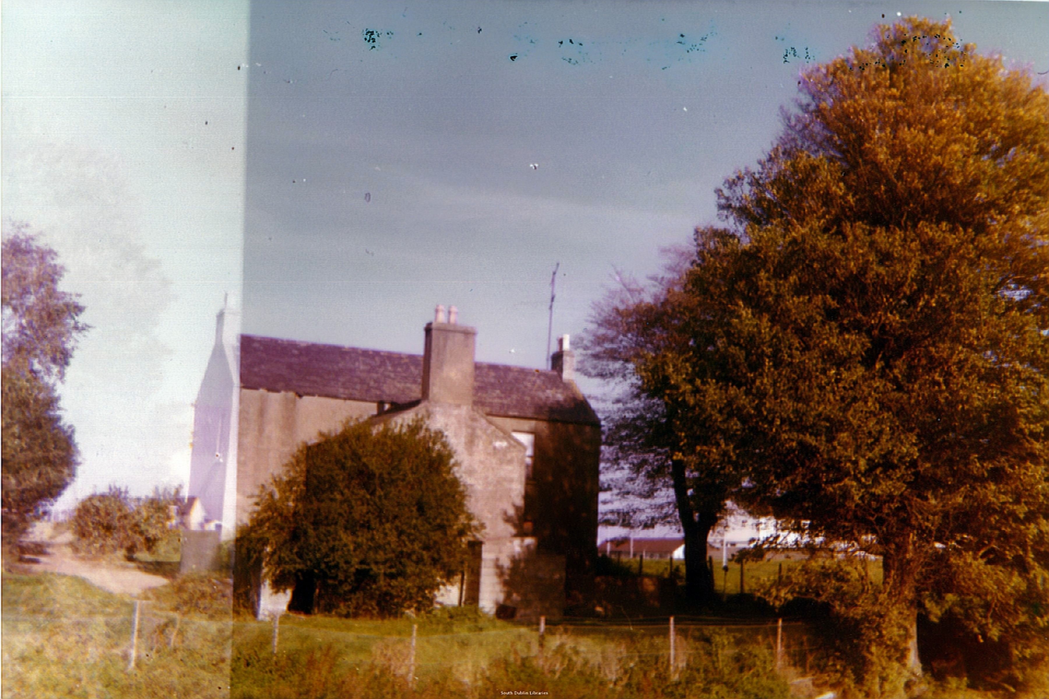
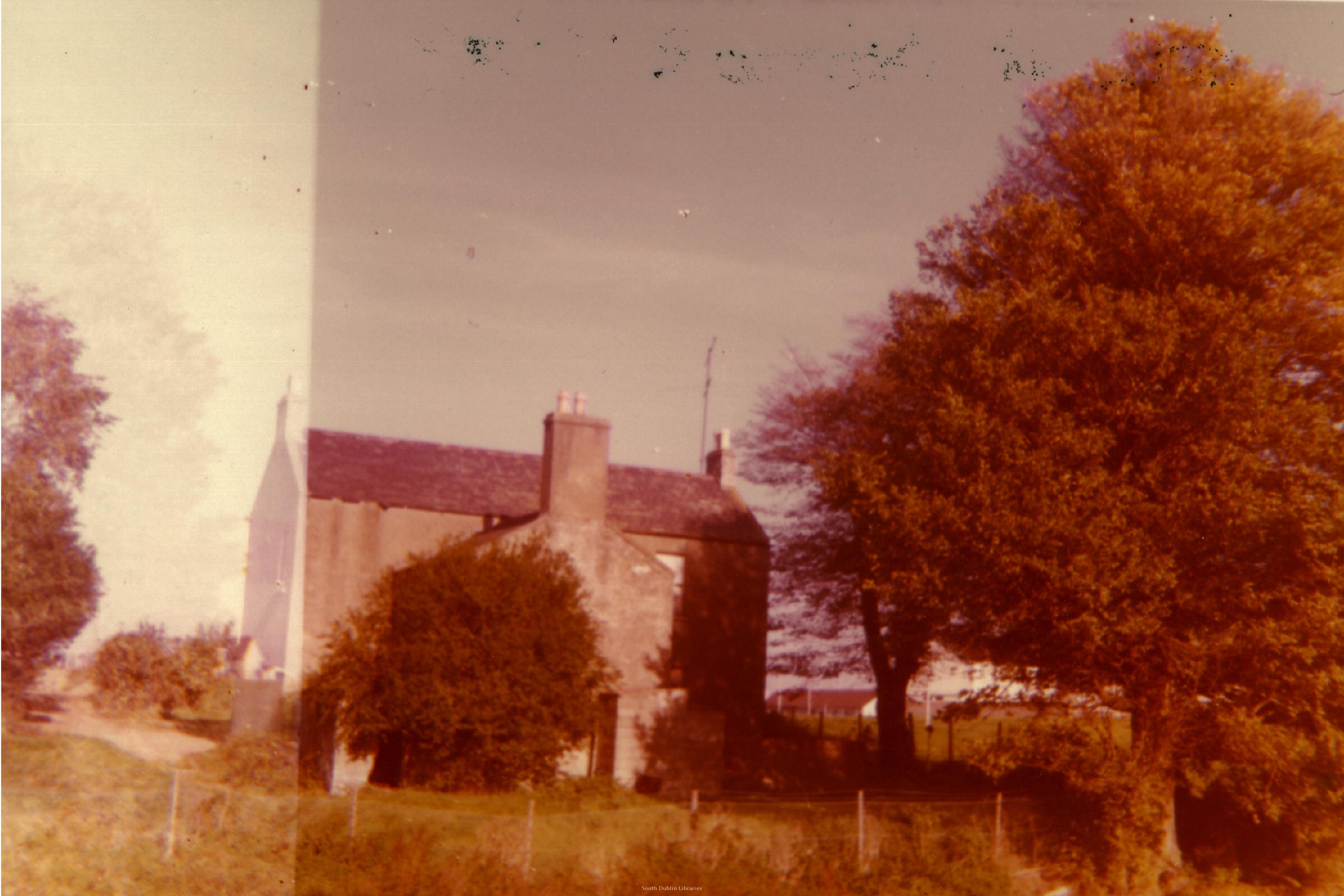
Similar shot.
Photo 1978.
Looks like that might be the modern bungalow in the background.
See full size.
Newtown Park
There is a modern road called
Newtown Park some distance to the W of the site.
[Liam Cosgrave]
says council houses were built here, called "Newtown Cottages".
A wider overlay
of the old and modern maps shows Newtown Park is on
what must be the W edge of the Stubbs estate (the field "9.554").
Newtown House was definitely not at this location.
