His son, the future
1st Viscount Fitzwilliam,
succeeded to Merrion in 1595.
See Merrion Castle in the "riding of the bounds" of Dublin in 1603.
The castle
was damaged in the
Irish Confederate Wars (1641 to 1653).
It was overrun by the rebels in 1642.
It was later taken and garrisoned by the Parliamentarians as at 1648.
It was afterwards restored.
The 1st Viscount died c.1655.
The
2nd Viscount Fitzwilliam (1st Earl of Tyrconnel)
died at Merrion Castle in 1667.
The
4th Viscount Fitzwilliam
spent time living in England, and Merrion Castle fell into disrepair.
The 4th Viscount died 1705 (new style year).
The castle was
abandoned by the
5th Viscount Fitzwilliam
in 1710.
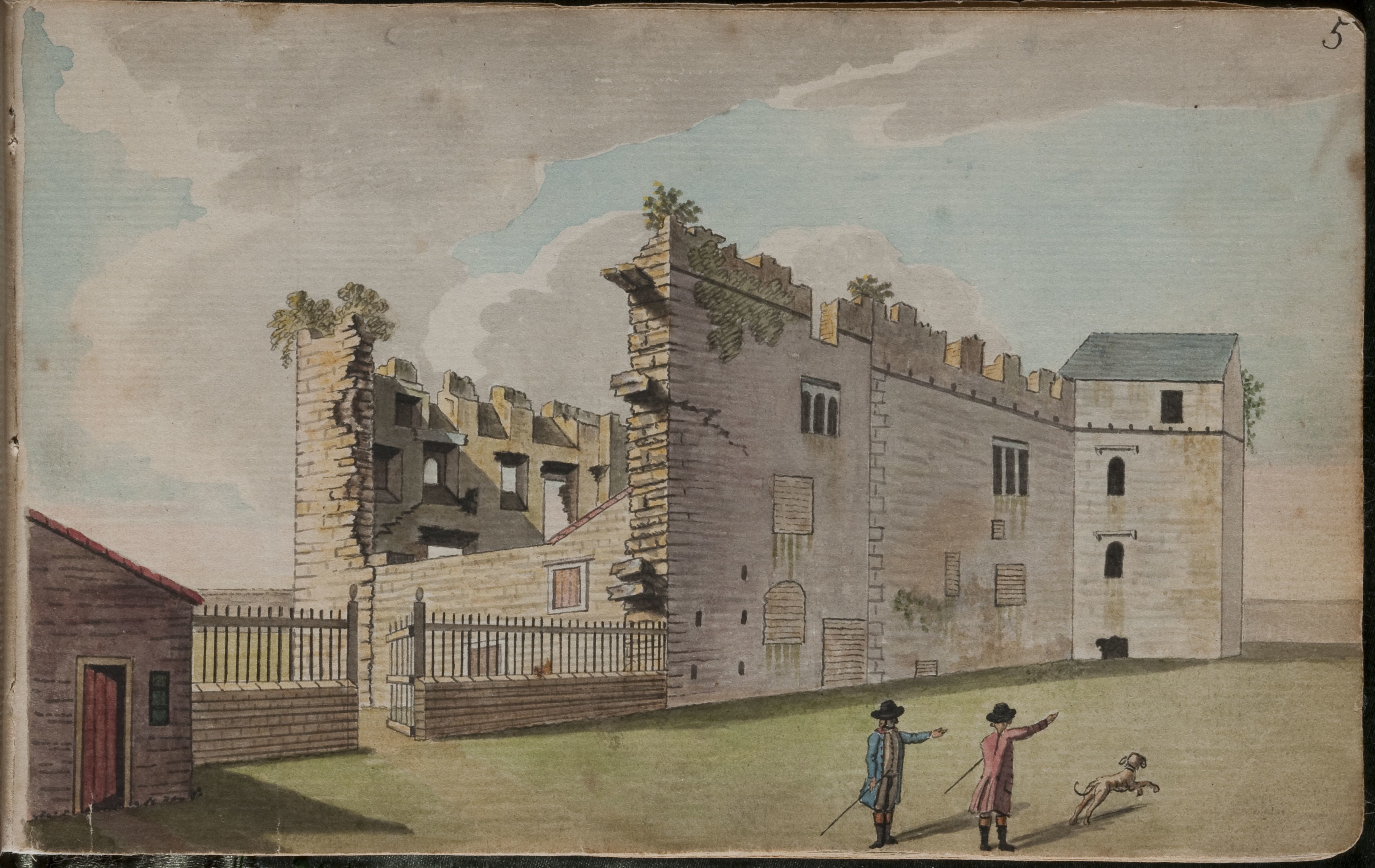
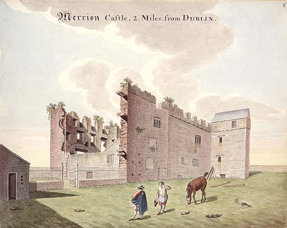
Merrion Castle had sunk into decay by 1729.
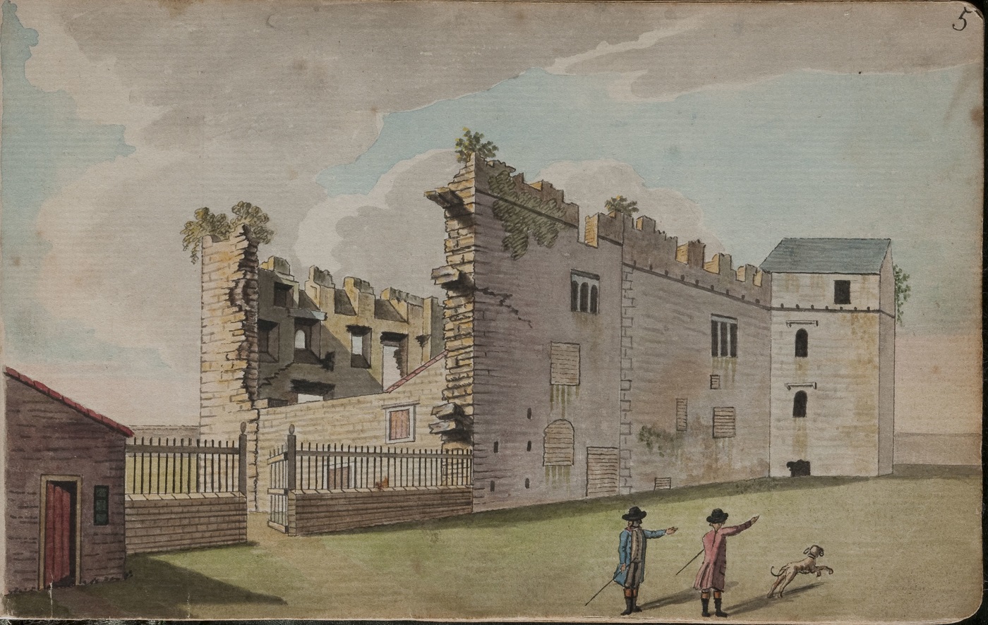
The ruins of Merrion Castle were described by Austin Cooper in 1780,
and were being removed in 1780-1781.
But a ruin survived for many years.
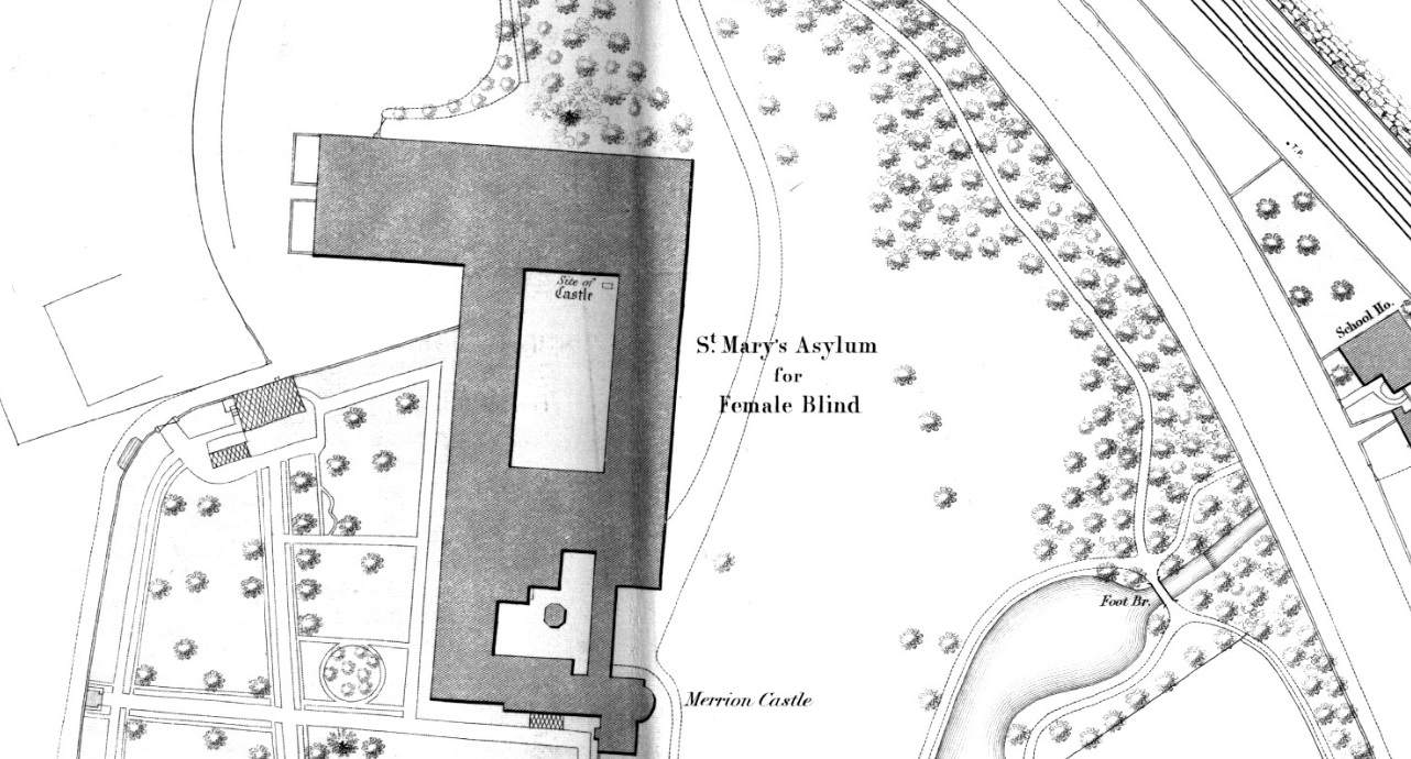
The site became
St.Mary's Centre,
school for the blind
and
nursing home.
It had an area of residences called "Fitzwilliam".
It closed in 2020.
The site awaits redevelopment.
A medieval stone plaque, bearing the Fitzwilliam coat of arms,
survives
at the site.
A medieval stone head
also survives.
A bit to the SE (along the coast road) is
Merrion graveyard.
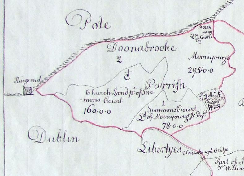
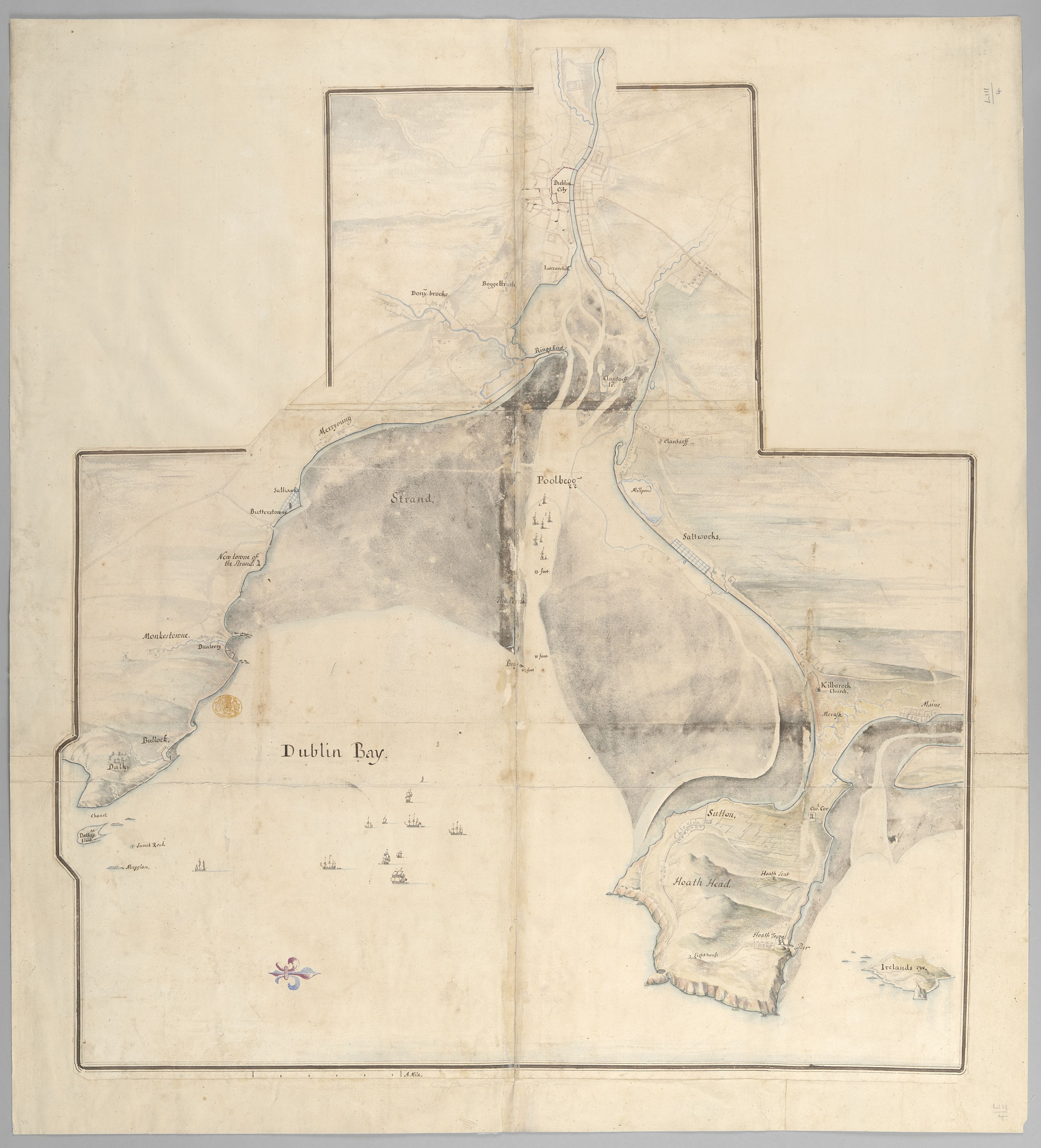
"Merryoung" (Merrion) on
Map of Dublin bay, 1685.
E (sea) is down.
See full size.
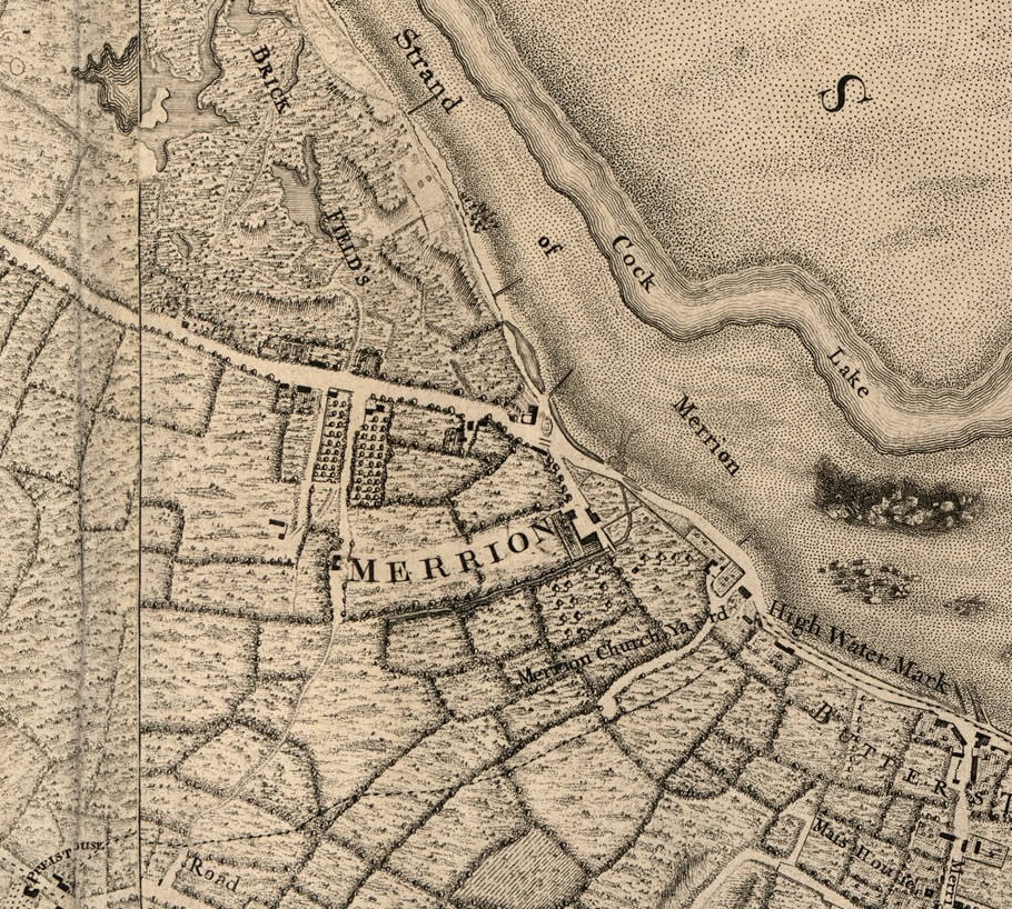
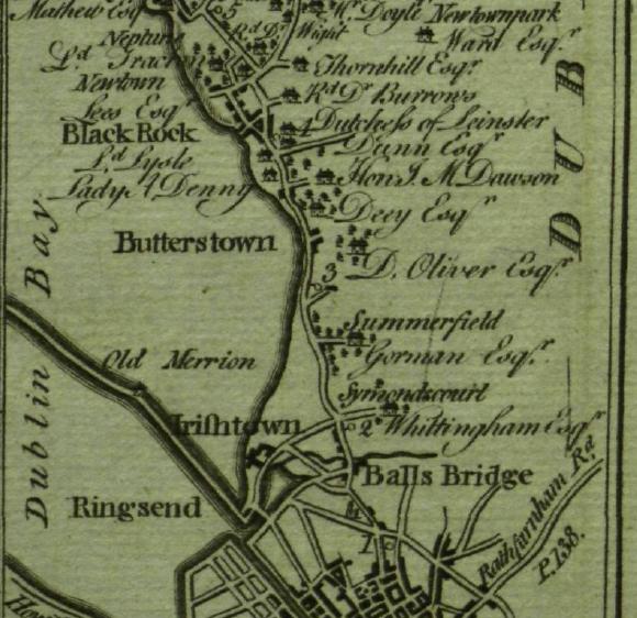
Merrion and Merrion graveyard on
John Rocque's map of Dublin, 1757.
Merrion Castle existed as a large ruin at this time.
It must be the complex beside the stream, with the small bridge over it.
To the NW are "Lord Merrion's Brick Fields".
To the SE is
Booterstown.
Merrion is visible (but not marked)
in
[Taylor and Skinner, 1777].
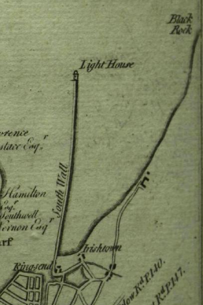
It is at the end of the road leading to the coast.
E is up.
Merrion
in
[Taylor and Skinner, 1777].
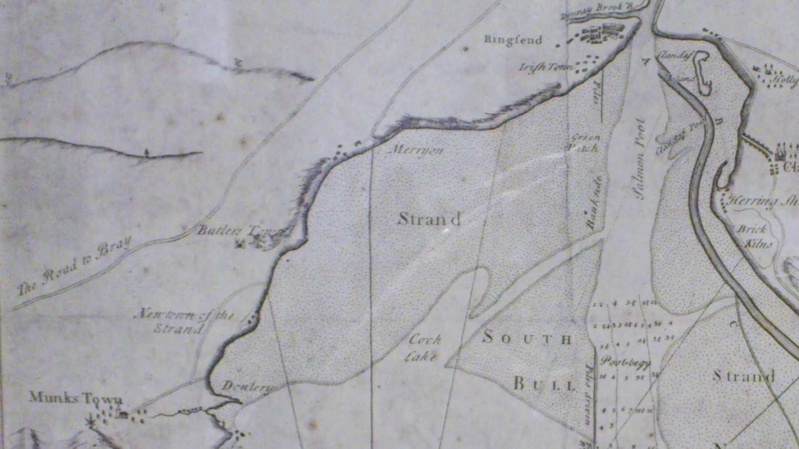
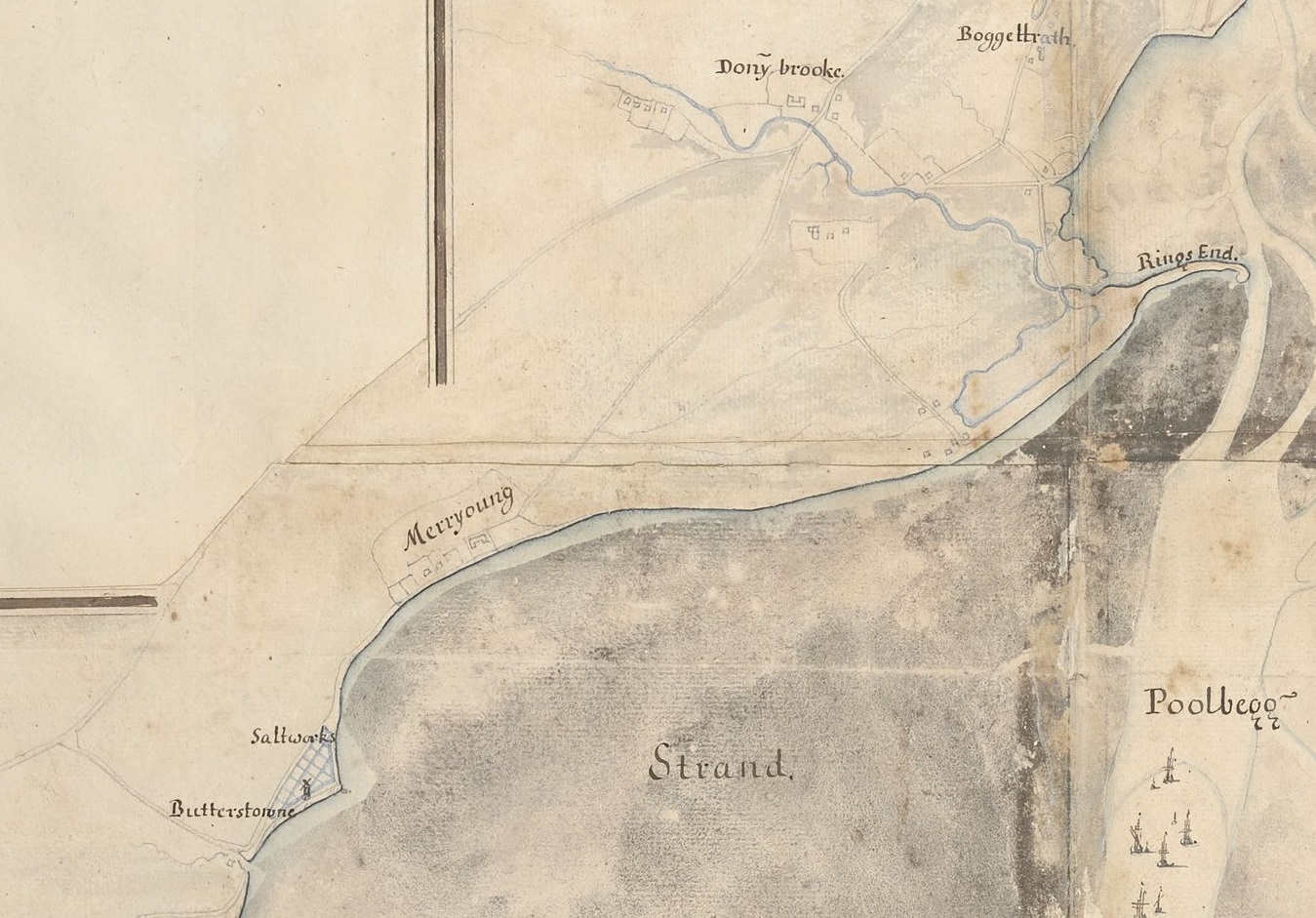
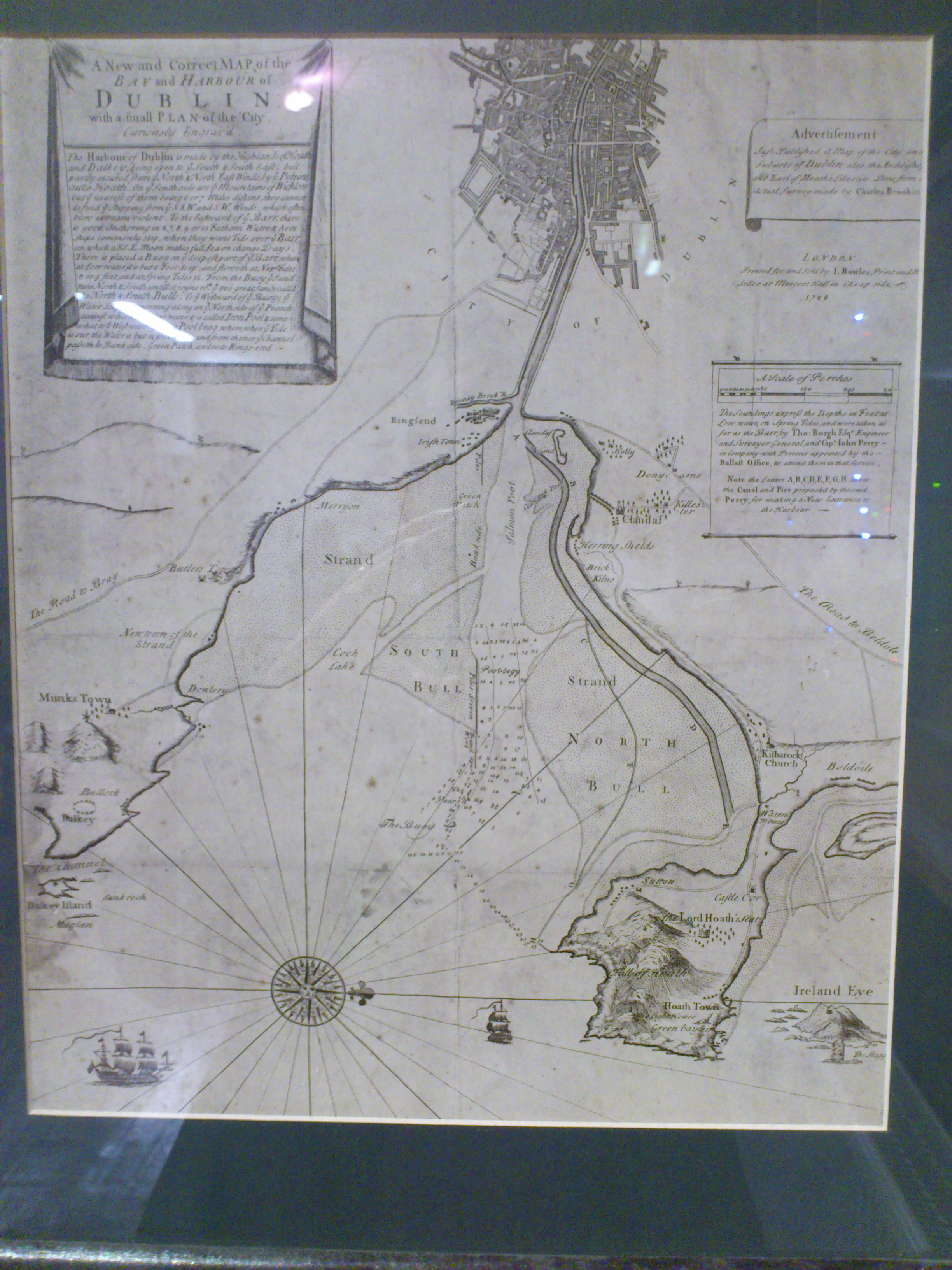
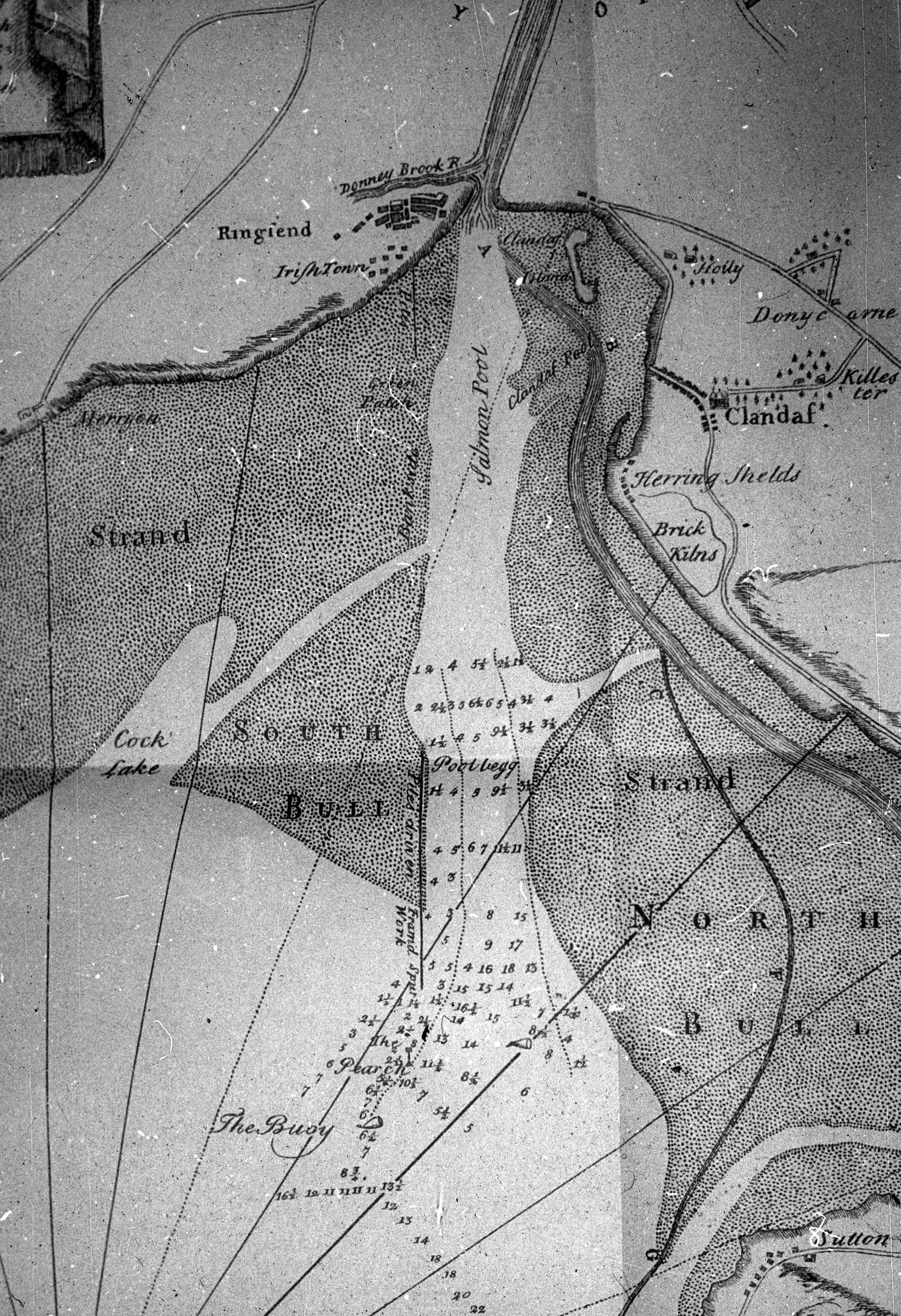
Merrion ("Merryon")
on map of
Dublin Bay, 1798.
On display at
National Maritime Museum,
Dun Laoghaire.
W is up.
"Butters Town" is
Booterstown.
See
full size
and
other shot.
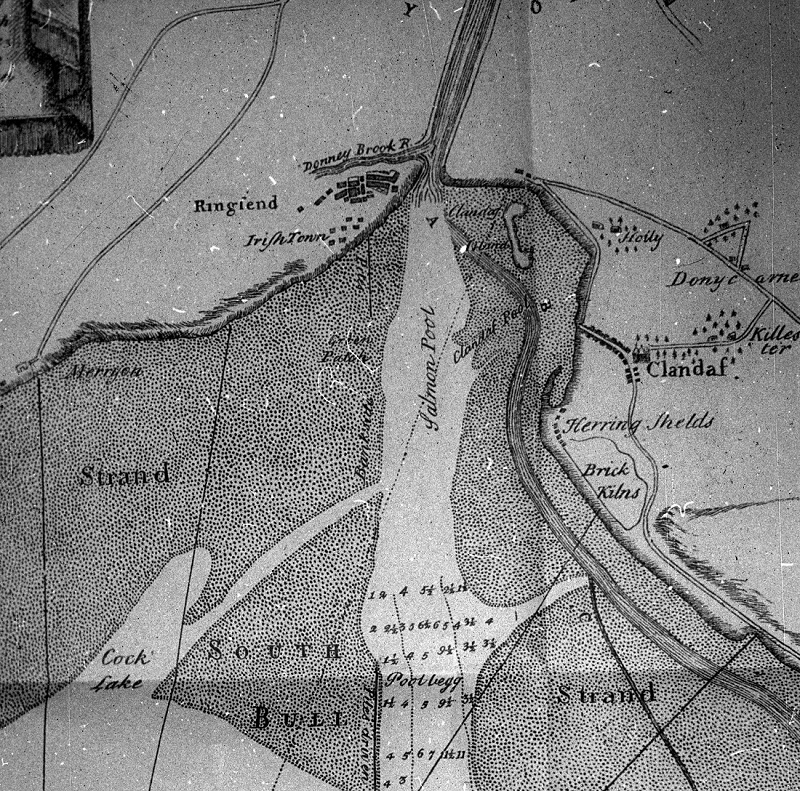
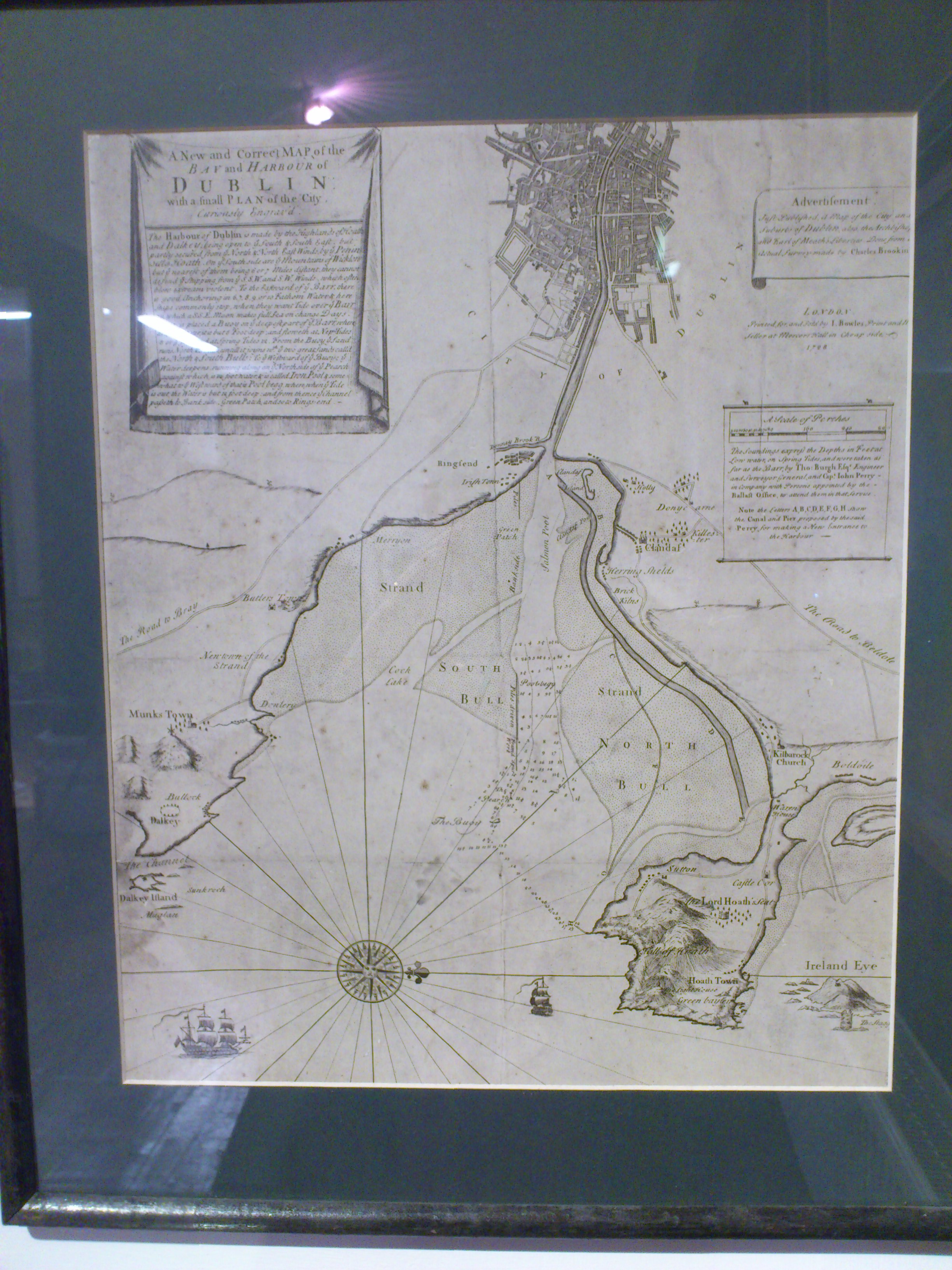
Merrion ("Merryon")
on other copy of same map.
From South Dublin Libraries,
which however thinks it is a map of 1728.
See full size.
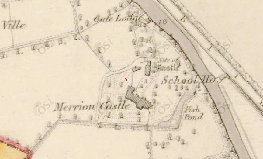
Merrion Castle site on
1829 to 1842 map.
There is a new "Merrion Castle" building at the site.
Ordnance Survey of Ireland map.
Date created: 1865.
From here.
The castle site is marked.
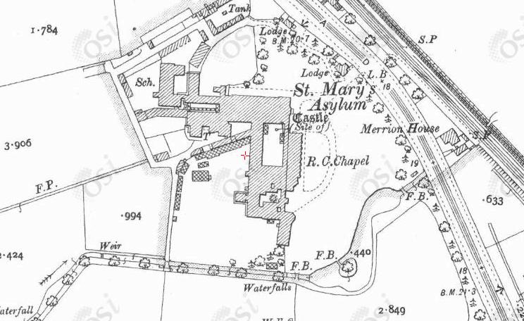
Merrion Castle site on
1887 to 1913 map.
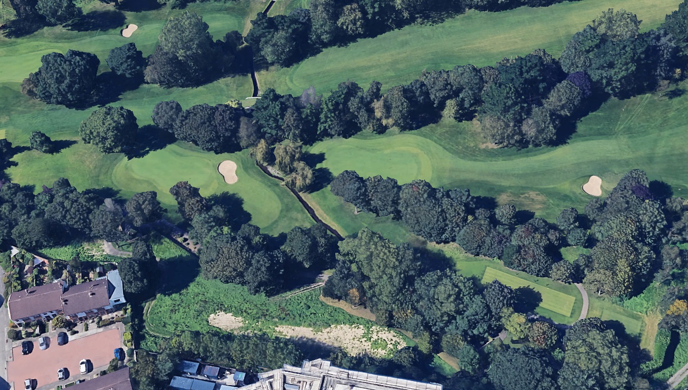
Elm Park Stream
still flows today through the grounds.
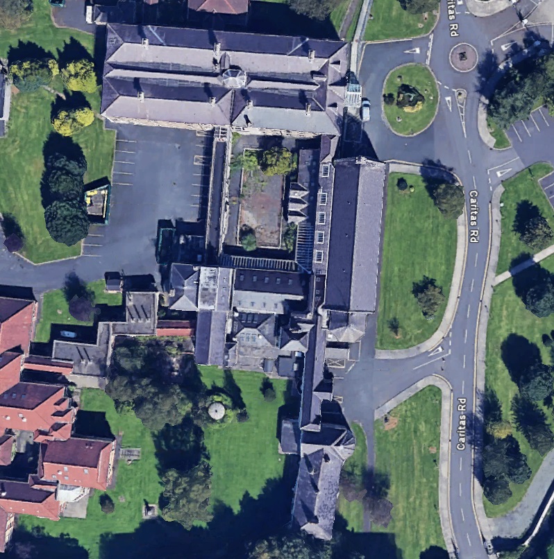
Modern
satellite view.
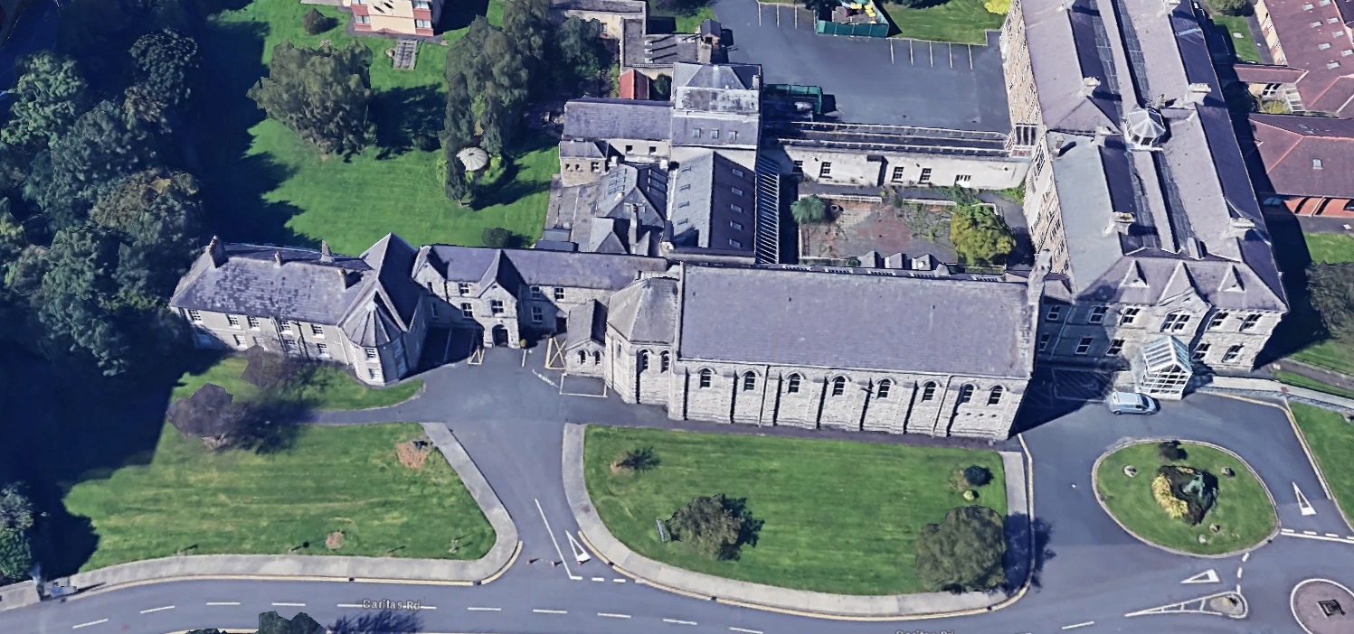
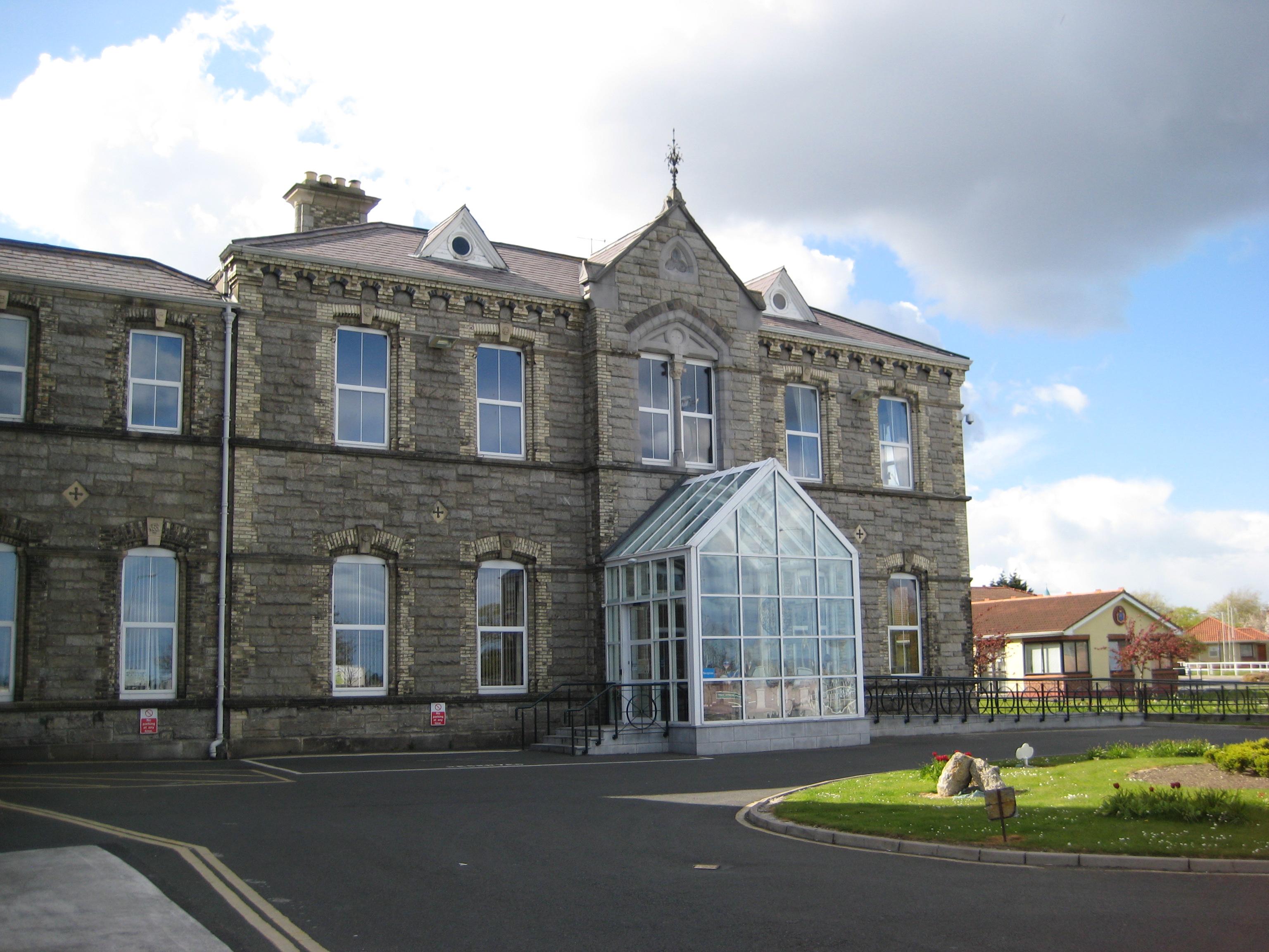
Site of castle is around the N end of the courtyard of St.Mary's School for the Blind.
On the outside is the front door (porch).
See
street view.
3D view from
Google Maps.
Site of castle is around RHS end of courtyard.
The 18th century Merrion Castle survives on the LHS end here.
See 2012 photo of front door (porch).
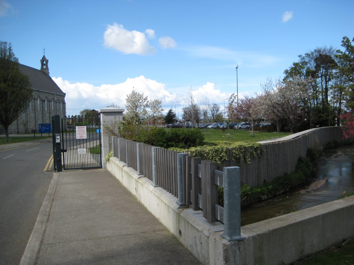
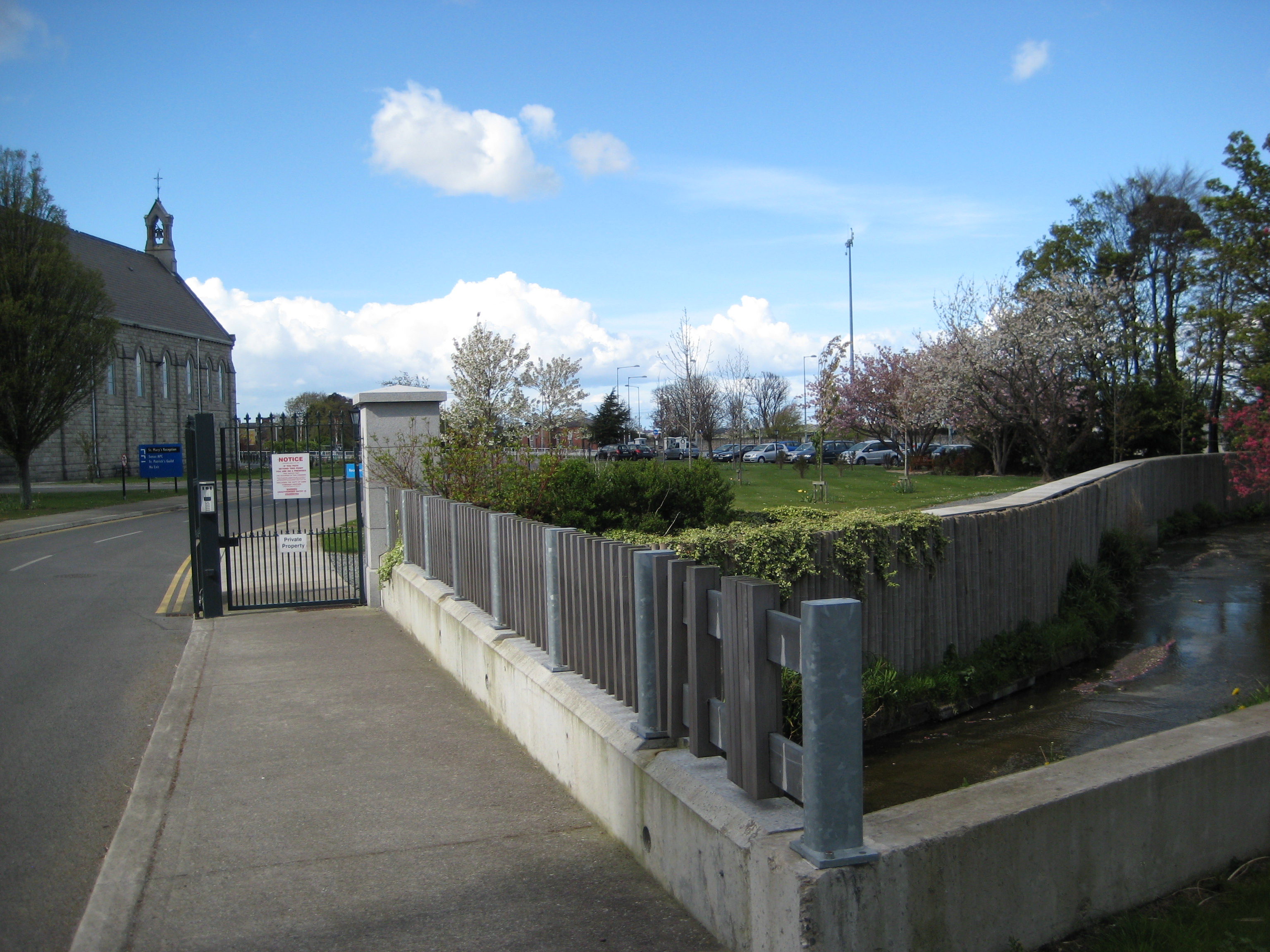
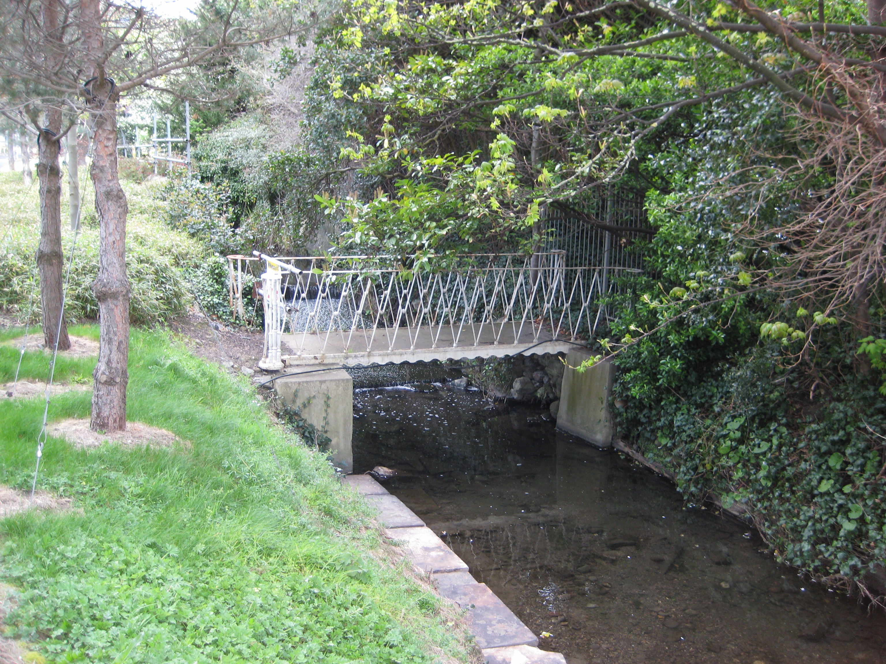
Bridge over the stream, looking N, showing (on LHS) St.Mary's (the site of the castle)
and (on RHS) the stream heading towards the sea.
Photo 2012.
See full size.
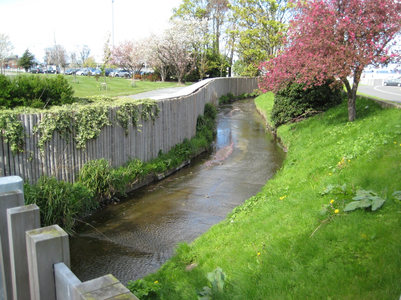
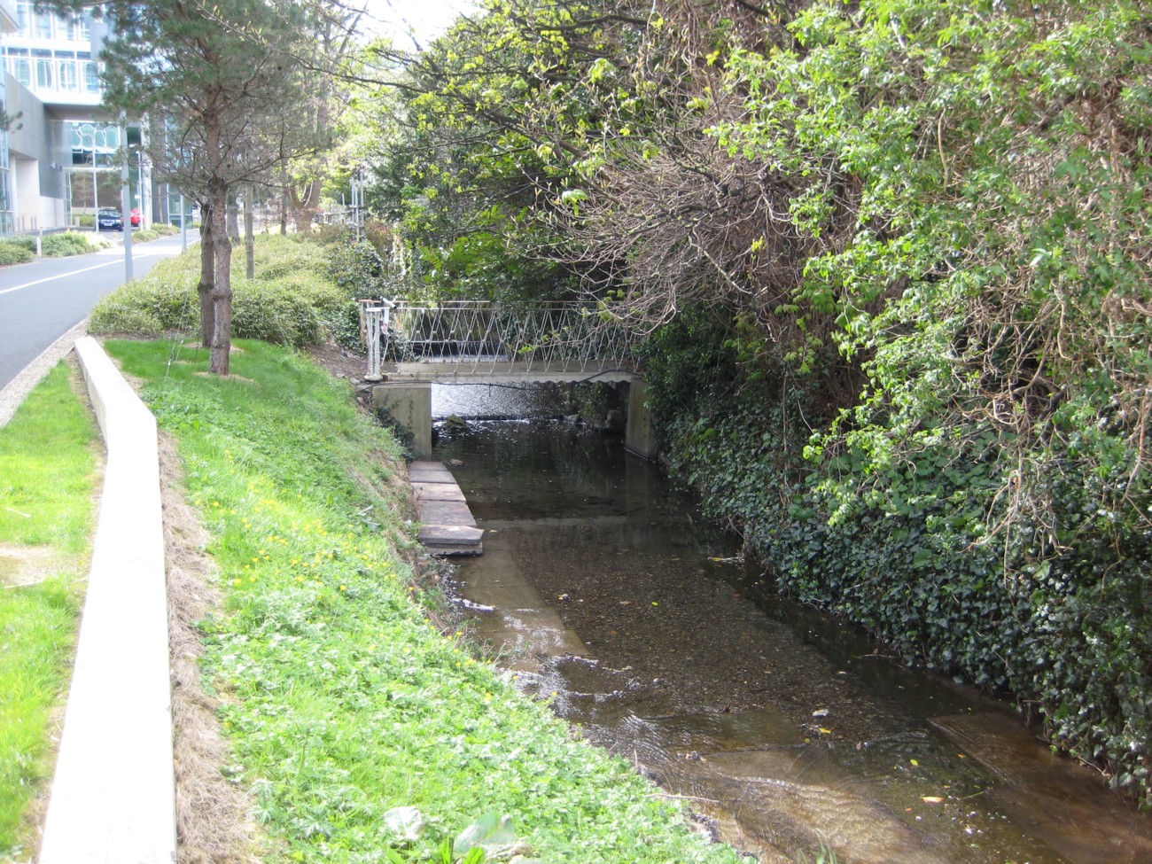
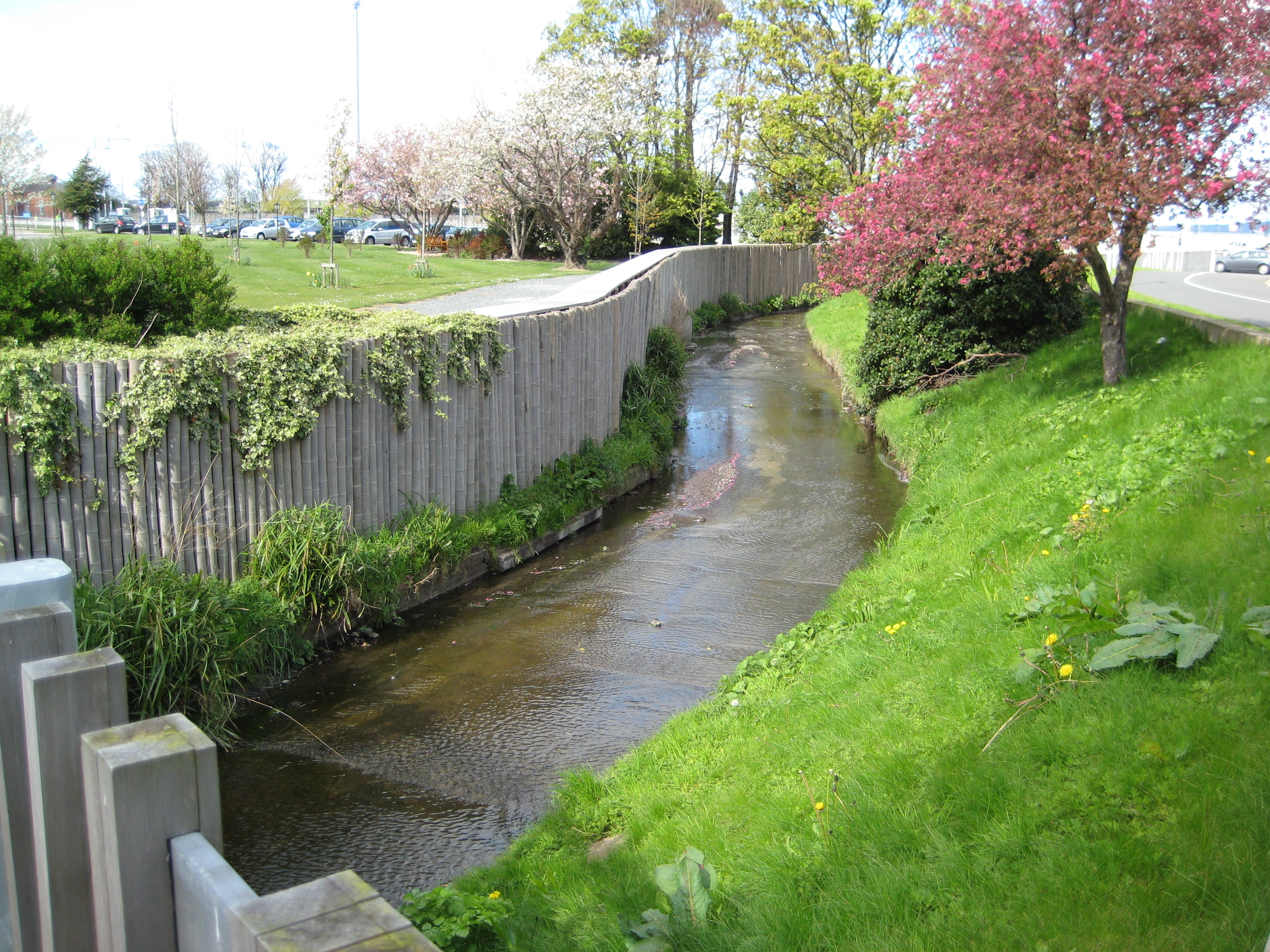
The Merrion Castle stream heading towards the sea.
From the bridge above.
Photo 2012.
See full size.
See other shot.
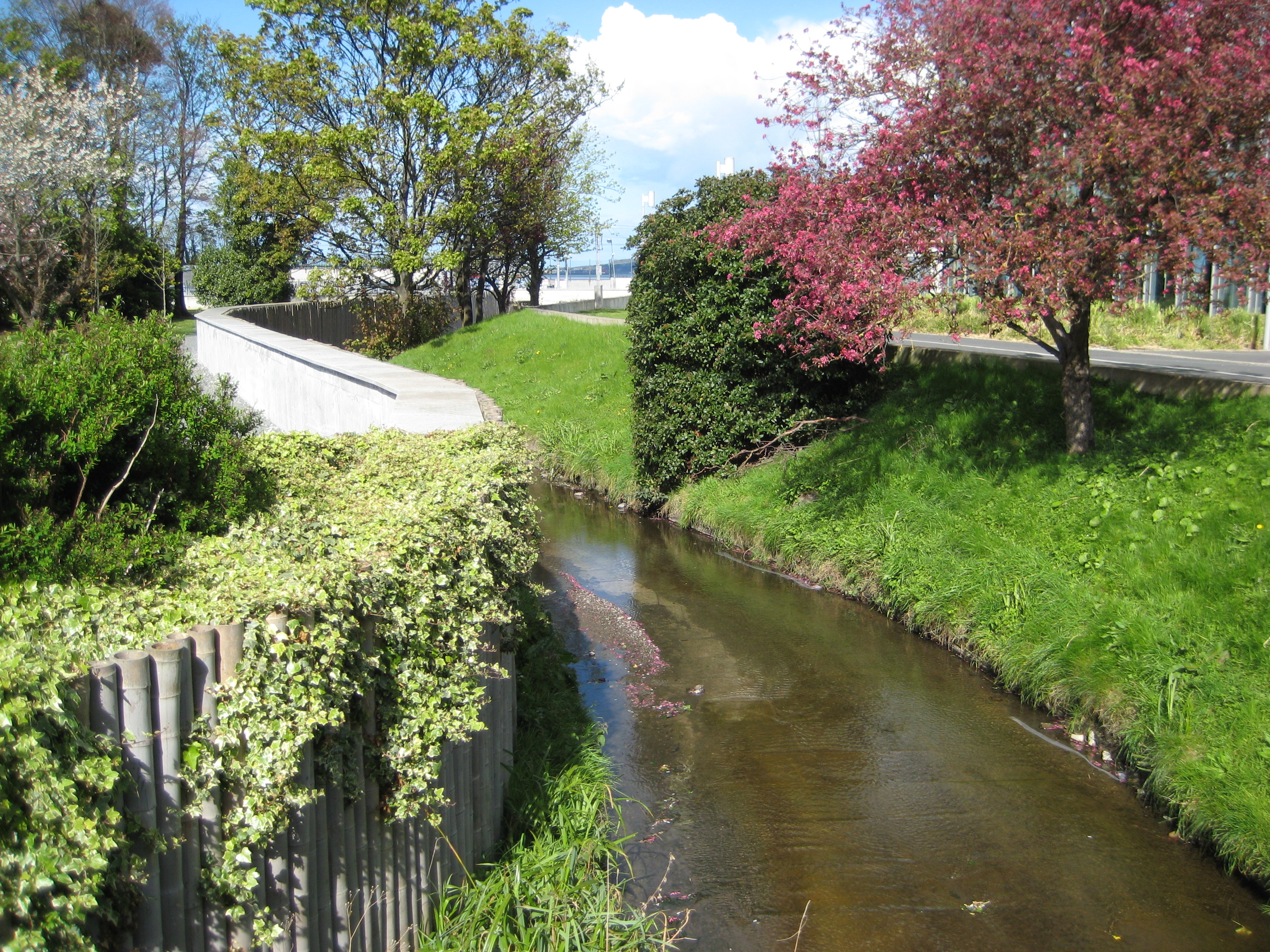
The Merrion Castle stream.
From the bridge above, looking away from the sea (to the W).
Photo 2012.
See full size.
See other shot.
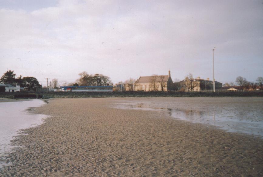
St.Mary's (on RHS) from Merrion strand,
showing on LHS where the Merrion Castle stream flows into the sea.
Photo 2000.
Once the castle would have been the only building visible
in this shot.
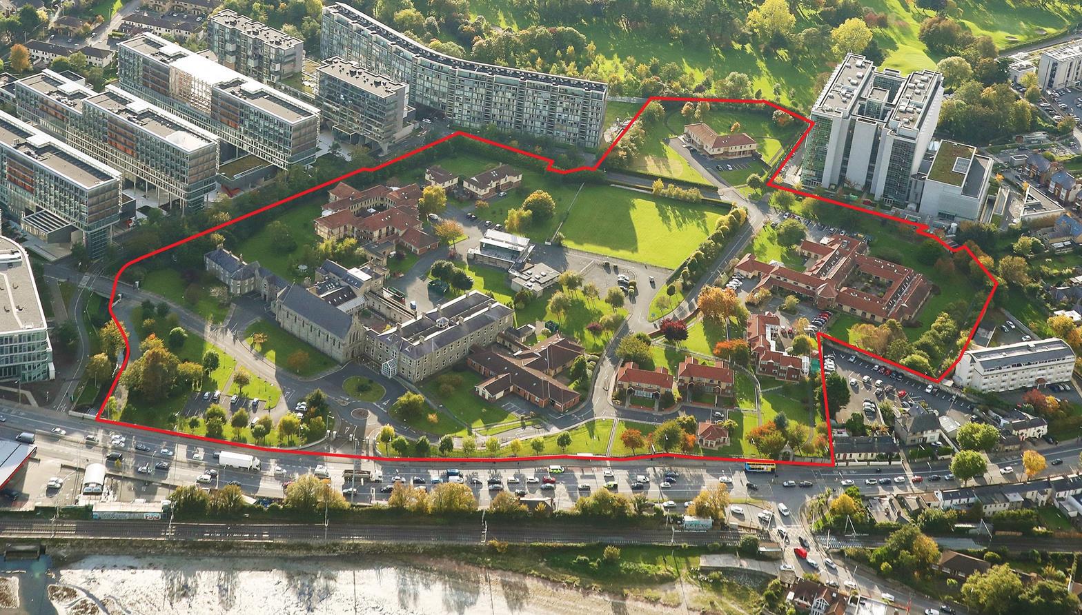
View of the St.Mary's site for redevelopment.
From a
2022 report
on the future of the site.
Please donate to support this site.
I have spent a great deal of time and money on this research.
Research involves travel and many expenses.
Some research "things to do"
are not done for years, because I do not have the money to do them.
Please Donate Here
to support the ongoing research and
to keep this website free.
